Area Overview for LA4 4SZ
Photos of LA4 4SZ
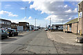
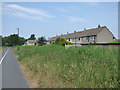
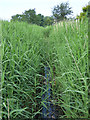
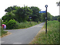
45 photos from this area
Area Information
Key information about the LA4 4SZ including its size, population, and administrative classification.
- Area Type
- Postcode
- Area Size
- 8355 m²
- Population
- 1404
- Population Density
- 1153 people/km²
House Prices in LA4 4SZ
14
Properties
£117,688
Average Sold Price
£9,500
Lowest Price
£190,000
Highest Price
Showing 14 properties
| Address | Type | Beds | Baths | Last Sale Price | Last Sale Date | |
|---|---|---|---|---|---|---|
| 4 Glentworth Road West, Morecambe, LA4 4SZ | Semi-detached | 3 | 1 | £9,500 | Dec 2020 | |
| 7 Glentworth Road West, Morecambe, LA4 4SZ | Bungalow | 2 | - | £155,000 | Aug 2019 | |
| 6 Glentworth Road West, Morecambe, LA4 4SZ | retail_financial | - | - | £190,000 | Apr 2019 | |
| 5 Glentworth Road West, Morecambe, LA4 4SZ | Bungalow | 3 | 1 | £170,000 | Jun 2017 | |
| 8 Glentworth Road West, Morecambe, LA4 4SZ | Bungalow | 2 | 1 | £130,000 | Jun 2015 | |
| 10 Glentworth Road West, Morecambe, LA4 4SZ | Bungalow | - | - | £103,000 | Aug 2013 | |
| 1 Glentworth Road West, Morecambe, LA4 4SZ | Retail | - | - | £128,000 | Jun 2007 | |
| 3 Glentworth Road West, Morecambe, LA4 4SZ | retail_financial | - | - | £56,000 | Jun 1999 | |
| 9 Glentworth Road West, Morecambe, LA4 4SZ | Semi-detached | 2 | 1 | - | - | |
| 2 Glentworth Road West, Morecambe, LA4 4SZ | restaurant_cafe | - | - | - | - |
Page 1 of 2
Energy Efficiency in LA4 4SZ
Amenities
Schools
| Rank | School | Type | Entry gender | Ages |
|---|
Explore more schools in this area
Go to Schools tabDemographics
Household Size
Two person
most common
Accommodation Type
Houses
most common
Tenure
70
majority
Ethnic Group
White
most common
Religion
N/A
most common
Household Composition
N/A
most common
Age
47
median
Adults (30-64 years)
most common
Household Deprivation
N/A
with no deprivation
NS-SEC
24
in Lower managerial occupations
Explore more demographic insights in this area
Go to Demographics tabPlanning
Planning Constraints
- Flood RiskPremium
- Ramsar Wetland SitesPremium
- Area of Outstanding Natural BeautyPremium
- Protected Nature ReservePremium
- Protected WoodlandPremium