Area Overview for LA3 1GH
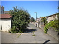
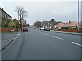
Photos of LA3 1GH


Area Information
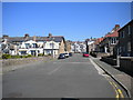
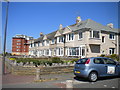
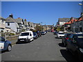
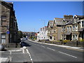
Living in LA3 1GH means being part of a tightly knit residential cluster in England, home to just 1,349 people. This small area is characterised by its quiet, suburban feel, with a strong emphasis on homeownership and family-oriented living. The community is predominantly composed of adults aged 30–64, many of whom own their homes. With no major environmental constraints or flood risks, the area offers a stable, low-stress environment. Residents benefit from proximity to essential transport links, including four railway stations and a ferry terminal, making commuting to nearby towns like Morecambe and Heysham straightforward. The broadband connectivity is near-perfect, with a score of 99, ensuring seamless internet access for remote work or entertainment. While the area lacks large-scale amenities, its compact size means daily needs are met by nearby shops and services. LA3 1GH is ideal for those seeking a peaceful, well-connected base with minimal disruption, though its small population means it’s not suited for those needing a bustling urban lifestyle.
- Area Type
- Postcode
- Area Size
- Not available
- Population
- 1349
- Population Density
- 5047 people/km²
The property market in LA3 1GH is dominated by owner-occupied homes, with 64% of residents owning their properties. This contrasts with areas where rental demand drives the market, indicating a community of long-term residents rather than transient tenants. The accommodation type is primarily houses, which aligns with the area’s suburban character and the preference for spacious, private living. Given the small population and limited land area, the housing stock is likely to be tightly clustered, with limited scope for new developments. Buyers should consider the proximity to transport links, such as the nearby railway stations and ferry terminal, which enhance the area’s appeal for commuters. However, the compact size of LA3 1GH means the property market is niche, with fewer options compared to larger towns. For those seeking a quiet, stable environment with strong connectivity, this area could be a good fit, though competition for available homes may be higher due to its limited supply.
House Prices in LA3 1GH
No properties found in this postcode.
Energy Efficiency in LA3 1GH
The lifestyle in LA3 1GH is shaped by its proximity to essential amenities, including five retail outlets such as Morrisons Daily, Tesco Heysham, and Tesco Morecambe. These shops provide convenient access to groceries and everyday essentials, reducing the need for long journeys. The area’s transport links are a key feature, with four railway stations — including Bare Lane and Morecambe — offering regular services to nearby towns. The Heysham Ferry Terminal adds a unique dimension, enabling trips to the Isle of Man for leisure or business. While the area lacks large parks or entertainment venues, its compact size fosters a sense of community, with local shops and transport nodes serving as social hubs. For residents, daily life revolves around practicality and connectivity, with the convenience of nearby services balancing the area’s quiet, suburban character. The mix of retail, rail, and ferry access ensures that LA3 1GH is well-equipped to meet both routine and occasional needs.
Amenities
Schools
| Rank | School | Type | Entry gender | Ages |
|---|
Explore more schools in this area
Go to Schools tabDemographics
The population of LA3 1GH is 1,349, with a median age of 47, indicating a mature, settled community. The most common age range is adults aged 30–64, suggesting a mix of established families and professionals. Homeownership is high at 64%, with the majority of properties being houses rather than flats. This reflects a preference for traditional, spacious living. The predominant ethnic group is White, though no specific data on diversity or deprivation levels is provided. The age profile implies a community focused on stability, with fewer young families or retirees compared to other areas. The high home ownership rate suggests long-term residency, with residents likely prioritising property investment over rental housing. The lack of demographic diversity data means the area’s cultural composition remains unexplored in this context, but the existing figures paint a picture of a cohesive, middle-aged population with strong ties to their homes.
Household Size
Accommodation Type
Tenure
Ethnic Group
Religion
Household Composition
Age
Household Deprivation
NS-SEC
Explore more demographic insights in this area
Go to Demographics tabPlanning
Planning Constraints
- Flood RiskPremium
- Ramsar Wetland SitesPremium
- Area of Outstanding Natural BeautyPremium
- Protected Nature ReservePremium
- Protected WoodlandPremium