Area Overview for LA22 9TE
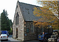
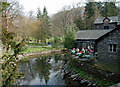
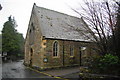
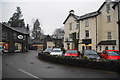
Photos of LA22 9TE


Area Information
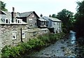
Living in LA22 9TE means being part of a small, tightly knit residential cluster in England. With a population of just 1,291 people spread over a low-density area, this postcode feels more like a village than a city. The community is predominantly composed of adults aged 30–64, reflecting a mature demographic profile. Daily life here is shaped by proximity to natural features and local amenities. The area’s low flood risk and absence of protected landscapes suggest a straightforward living environment, though crime rates sit at an average level. Residents benefit from nearby primary schools, retail outlets, and ferry services, making it practical for families and commuters. The modest population and sparse development mean LA22 9TE lacks the hustle of larger towns but offers a quieter, more manageable pace of life. For those seeking a low-maintenance, community-focused home, this area provides a balance of accessibility and seclusion, with no major planning constraints to complicate property ownership.
- Area Type
- Postcode
- Area Size
- Not available
- Population
- 1291
- Population Density
- 15 people/km²
The property market in LA22 9TE is characterised by a 46% home ownership rate, with houses being the primary accommodation type. This suggests a mix of owner-occupied and rental properties, though the relatively low ownership percentage may indicate a reliance on private rentals or shared ownership models. The small population and low density mean the housing stock is limited, with no indication of high-rise developments or large-scale residential projects. For buyers, this small area offers a niche market where properties are likely to be family homes rather than investment opportunities. The lack of planning constraints and environmental restrictions simplifies the buying process, though the modest size of the area means competition for properties could be keen. Prospective buyers should consider the limited availability of homes and the potential for long-term residency rather than short-term turnover.
House Prices in LA22 9TE
No properties found in this postcode.
Energy Efficiency in LA22 9TE
The lifestyle in LA22 9TE is shaped by its proximity to retail and ferry services, which provide essential amenities within practical reach. Local shops include Co-op Grasmere, Langdale Co-operative Society, and Budgens Ambleside, offering everyday necessities for residents. The ferry network, with stops at Ambleside Waterhead Ferry Landing and Brockhole Ferry Landing, adds a layer of connectivity, particularly for those using water-based travel. These amenities contribute to a self-contained, low-stress lifestyle, where daily errands and leisure activities can be managed without long commutes. The area’s small size and limited development mean the character of LA22 9TE is defined by its simplicity and reliance on nearby towns for more specialised services. For those valuing convenience and a quiet environment, the combination of retail outlets and ferry access offers a practical, if modest, lifestyle foundation.
Amenities
Schools
Residents of LA22 9TE have access to two primary schools: Grasmere CofE Primary School and Langdale CofE School, both of which hold a ‘good’ Ofsted rating. These institutions serve the local community, offering education for younger children in a setting that combines religious affiliation with state-funded provision. The presence of two primary schools within the area ensures that families have options for their children’s early education, though secondary schooling would require travel to nearby towns. The ‘good’ ratings suggest a baseline standard of teaching and facilities, though parents may need to look further afield for specialist provisions or higher education pathways. For families prioritising school quality, the proximity of these two schools is a practical advantage in this small postcode area.
| Rank | School | Type | Entry gender | Ages |
|---|
Explore more schools in this area
Go to Schools tabDemographics
The community in LA22 9TE is defined by its mature age profile, with a median age of 47 and most residents falling within the 30–64 age range. Home ownership is relatively low at 46%, suggesting a mix of owner-occupied and rental properties. The predominant ethnic group is White, and the accommodation type is primarily houses, reflecting a suburban or rural layout. This demographic structure indicates a stable, long-term resident base rather than a transient population. The low population density of 15 people per square kilometre further supports the idea of a spread-out, low-pressure living environment. While deprivation data is not provided, the absence of significant planning constraints and the presence of basic amenities suggest a moderate quality of life. The area’s appeal likely lies in its simplicity and accessibility to nearby services, catering to those prioritising tranquillity over urban convenience.
Household Size
Accommodation Type
Tenure
Ethnic Group
Religion
Household Composition
Age
Household Deprivation
NS-SEC
Explore more demographic insights in this area
Go to Demographics tabPlanning
Planning Constraints
- Flood RiskPremium
- Ramsar Wetland SitesPremium
- Area of Outstanding Natural BeautyPremium
- Protected Nature ReservePremium
- Protected WoodlandPremium