Area Overview for LA22 9NZ
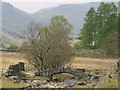
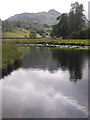
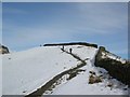
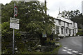
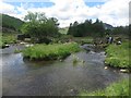
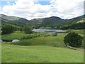
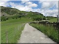
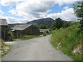
Photos of LA22 9NZ
Area Information
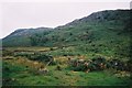
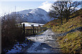
Living in LA22 9NZ means being part of a small, tightly knit residential cluster in England. The area spans 8.1 hectares and is home to 1,291 people, giving it a low population density of just 15 people per square kilometre. This suggests a quiet, uncluttered environment, typical of rural or semi-rural settings. The community is predominantly composed of adults aged 30–64, with a median age of 47, indicating a mature demographic. The area’s small size and sparse population mean daily life is likely characterised by a slower pace, with fewer crowds and a strong sense of local identity. Proximity to natural features and limited urban sprawl may contribute to a tranquil lifestyle, though the area’s remoteness could affect access to certain services. For those seeking a peaceful, low-density living environment, LA22 9NZ offers a distinct contrast to busier urban centres. Its small footprint also means that residents are likely to know their neighbours and share a communal approach to local amenities and events.
- Area Type
- Postcode
- Area Size
- 8.1 hectares
- Population
- 1291
- Population Density
- 15 people/km²
The property market in LA22 9NZ is defined by its low population density and small area size, which together suggest a limited housing stock. With 46% of homes owned by residents, the area is not heavily reliant on rental properties, though the exact proportion of rental versus owner-occupied homes is not specified. The accommodation type is predominantly houses, which may appeal to those seeking more space and privacy compared to flats. However, the small size of the area and the low population density could mean that the housing market is niche, with fewer options for buyers. This may be a consideration for those looking to purchase a home in the immediate vicinity, as the surrounding areas may offer more variety. The limited number of properties could also lead to competition among buyers, particularly for homes that meet specific criteria such as proximity to schools or transport links.
House Prices in LA22 9NZ
Showing 4 properties
| Address | Type | Beds | Baths | Last Sale Price | Last Sale Date | |
|---|---|---|---|---|---|---|
| Bungalow 1, Three Shires Inn, Little Langdale, Ambleside, LA22 9NZ | Terraced | - | - | - | - | |
| Bungalow 2, Three Shires Inn, Little Langdale, Ambleside, LA22 9NZ | Terraced | - | - | - | - | |
| Three Shires Inn, Little Langdale, Ambleside, LA22 9NZ | restaurant_cafe | - | - | - | - | |
| Staff Accommodation, Three Shires Inn, Little Langdale, Ambleside, LA22 9NZ | Flat | - | - | - | - |
Energy Efficiency in LA22 9NZ
Residents of LA22 9NZ have access to a modest selection of retail and leisure amenities within practical reach. Notable retail options include Langdale Co-operative Society, Co-op Grasmere, and Budgens Ambleside, providing basic shopping needs. The area also boasts five ferry landing points, including Monk Coniston Ferry Landing and Ambleside Waterhead Ferry Landing, which may offer convenient access to water-based transport and leisure activities. These ferry services could be particularly valuable for those who enjoy boating, fishing, or exploring nearby waterways. While the number of amenities is limited, their presence suggests a focus on practicality and local connectivity. The combination of retail outlets and ferry access contributes to a lifestyle that balances simplicity with functional convenience, ideal for those who prefer a low-key, community-oriented way of living.
Amenities
Schools
Residents of LA22 9NZ have access to two primary schools: Grasmere CofE Primary School and Langdale CofE School. Both institutions hold a ‘good’ Ofsted rating, indicating a satisfactory standard of education. The presence of two primary schools suggests that the area is well-served for families with young children, though no secondary schools are listed in the data. The fact that both schools are Church of England affiliated may reflect the local demographic and religious landscape. For families prioritising primary education, the availability of two schools with positive ratings is a significant advantage. However, the absence of secondary schooling in the immediate area could require commuting to nearby towns for older children. The quality of primary education here appears to be a key selling point for the area.
| Rank | School | Type | Entry gender | Ages |
|---|
Explore more schools in this area
Go to Schools tabDemographics
The community in LA22 9NZ is predominantly composed of adults aged 30–64, with a median age of 47. This suggests a mature population, likely with established careers and family structures. Home ownership is at 46%, which is slightly below the national average, indicating a mix of owner-occupied and rented properties. The area is primarily composed of houses rather than flats or apartments, reflecting a preference for larger, more private living spaces. The predominant ethnic group is White, though no specific data on diversity or minority populations is provided. The low population density of 15 people per square kilometre implies a spread-out, possibly rural or semi-rural character, which may influence social dynamics and access to services. The absence of detailed data on deprivation or income levels means that quality of life factors such as affordability or access to public services cannot be assessed from this information alone.
Household Size
Accommodation Type
Tenure
Ethnic Group
Religion
Household Composition
Age
Household Deprivation
NS-SEC
Explore more demographic insights in this area
Go to Demographics tabPlanning
Planning Constraints
- Flood RiskPremium
- Ramsar Wetland SitesPremium
- Area of Outstanding Natural BeautyPremium
- Protected Nature ReservePremium
- Protected WoodlandPremium