Area Overview for LA22 9LE
Photos of LA22 9LE
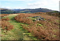
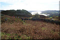
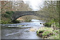
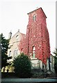
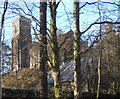
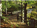
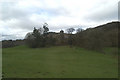

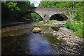

100 photos from this area
Area Information
Key information about the LA22 9LE including its size, population, and administrative classification.
- Area Type
- Postcode
- Area Size
- 8.9 hectares
- Population
- 1291
- Population Density
- 15 people/km²
House Prices in LA22 9LE
31
Properties
£320,064
Average Sold Price
£86,000
Lowest Price
£505,000
Highest Price
Showing 31 properties
| Address | Type | Beds | Baths | Last Sale Price | Last Sale Date | |
|---|---|---|---|---|---|---|
| 10, The Croft, Clappersgate, Ambleside, LA22 9LE | Flat | - | - | £327,000 | Jul 2023 | |
| 6, The Croft, Clappersgate, Ambleside, LA22 9LE | Flat | - | - | £424,000 | Dec 2022 | |
| Rose Cottage, Clappersgate, Ambleside, LA22 9LE | house | - | - | £505,000 | Feb 2022 | |
| Gate House Cottage, Clappersgate, Ambleside, LA22 9LE | house | - | - | £375,000 | Jun 2014 | |
| 9, The Croft, Clappersgate, Ambleside, LA22 9LE | Flat | - | - | £265,000 | Jun 2013 | |
| 12, The Croft, Clappersgate, Ambleside, LA22 9LE | Flat | - | - | £164,000 | Feb 2013 | |
| 7, The Croft, Clappersgate, Ambleside, LA22 9LE | Flat | 4 | 1 | £374,700 | Jan 2011 | |
| 4, The Croft, Clappersgate, Ambleside, LA22 9LE | Flat | 3 | 1 | £345,000 | Aug 2010 | |
| Willow Hill, Clappersgate, Ambleside, LA22 9LE | house | - | - | £465,000 | Mar 2005 | |
| 3, The Croft, Clappersgate, Ambleside, LA22 9LE | Flat | - | - | £190,000 | Oct 2001 |
Page 1 of 4
Energy Efficiency in LA22 9LE
Amenities
Schools
| Rank | School | Type | Entry gender | Ages |
|---|
Explore more schools in this area
Go to Schools tabDemographics
Household Size
Two person
most common
Accommodation Type
Houses
most common
Tenure
46
majority
Ethnic Group
White
most common
Religion
N/A
most common
Household Composition
N/A
most common
Age
47
median
Adults (30-64 years)
most common
Household Deprivation
N/A
with no deprivation
NS-SEC
31
in Lower managerial occupations
Explore more demographic insights in this area
Go to Demographics tabPlanning
Planning Constraints
- Flood RiskPremium
- Ramsar Wetland SitesPremium
- Area of Outstanding Natural BeautyPremium
- Protected Nature ReservePremium
- Protected WoodlandPremium