Area Overview for LA22 9JX
Photos of LA22 9JX


Area Information
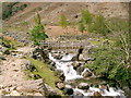
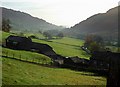
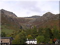
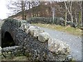
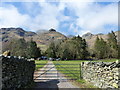
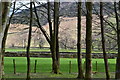
Living in LA22 9JX means being part of a small, tightly knit residential cluster in England. With a population of 1,291 spread across 4.3 hectares, the area is compact but offers a quiet, low-density lifestyle. The median age of 47 suggests a community of established residents, many in the 30–64 age range, which shapes a mature, stable environment. Daily life here is defined by proximity to natural and practical amenities. The area’s small size means residents can access essential services, including schools and ferry routes, within walking or short driving distance. While the population density is low at 15 people per square kilometre, this reflects a deliberate balance between open space and residential comfort. LA22 9JX is not a sprawling suburb but a focused cluster of homes, likely surrounded by rural or semi-rural landscapes. Its character is shaped by the mix of local shops, transport links, and the presence of nearby educational institutions, making it a self-contained yet connected place for those seeking a slower pace of life.
- Area Type
- Postcode
- Area Size
- 4.3 hectares
- Population
- 1291
- Population Density
- 15 people/km²
The property market in LA22 9JX is characterised by a 46% home ownership rate, indicating that nearly half of the area’s housing stock is owner-occupied. This suggests a community of long-term residents rather than a transient rental market. The accommodation type is primarily houses, which is typical of rural or semi-rural areas where larger properties are more common. Given the area’s small size—just 4.3 hectares—there is limited scope for expansion, meaning the housing stock is likely fixed and static. Buyers should consider that the market may be niche, with properties offering more space than density. The low population density also implies that the immediate surroundings may not offer a wide range of housing options, making LA22 9JX a specific choice for those seeking a quiet, house-based lifestyle.
House Prices in LA22 9JX
Showing 1 properties
| Address | Type | Beds | Baths | Last Sale Price | Last Sale Date | |
|---|---|---|---|---|---|---|
| Staff Accommodation, New Dungeon Ghyll Hotel, Great Langdale, Ambleside, LA22 9JX | Flat | - | - | - | - |
Energy Efficiency in LA22 9JX
The lifestyle in LA22 9JX is shaped by its proximity to retail and transport hubs. Within practical reach are five retail venues, including Co-op Grasmere, Budgens Ambleside, and Langdale Co-operative Society, providing basic shopping needs. These stores likely offer essentials such as groceries, household items, and local services. The area’s ferry network—comprising five landings like Waterhead Hotel Ferry Landing—adds a unique dimension to daily life, offering access to water-based travel for commuting or leisure. While the small size of LA22 9JX limits the variety of amenities, the presence of these services suggests a focus on convenience over diversity. The combination of local shops and ferry routes creates a practical, if minimal, lifestyle, ideal for those prioritising accessibility over urban vibrancy.
Amenities
Schools
Residents of LA22 9JX have access to two primary schools: Grasmere CofE Primary School and Langdale CofE School, both of which hold a ‘good’ Ofsted rating. These institutions provide quality primary education within the local area, reducing the need for long commutes for younger families. The presence of two primary schools suggests a focus on early education, though no secondary schools are listed in the data. This means parents may need to look further afield for secondary schooling, which could be a consideration for families planning long-term. The ‘good’ Ofsted ratings indicate that both schools meet national standards, offering a reliable foundation for children’s education. The proximity of these schools to homes in LA22 9JX reinforces the area’s appeal for families seeking a balanced, community-oriented lifestyle.
| Rank | School | Type | Entry gender | Ages |
|---|
Explore more schools in this area
Go to Schools tabDemographics
The community in LA22 9JX is predominantly composed of adults aged 30–64, with a median age of 47. This suggests a population largely in their prime working years, which may influence local services and amenities. Home ownership stands at 46%, indicating a mix of owner-occupied properties and rental housing. The accommodation type is primarily houses, reflecting a low-rise, residential character. The predominant ethnic group is White, which aligns with broader demographic trends in rural and semi-rural England. The low population density of 15 people per square kilometre implies a spread-out, less congested living environment. While no specific deprivation data is provided, the demographic profile suggests a community with established roots, likely prioritising stability over rapid change. This balance of age groups and housing types creates a cohesive, if unchanging, social fabric.
Household Size
Accommodation Type
Tenure
Ethnic Group
Religion
Household Composition
Age
Household Deprivation
NS-SEC
Explore more demographic insights in this area
Go to Demographics tabPlanning
Planning Constraints
- Flood RiskPremium
- Ramsar Wetland SitesPremium
- Area of Outstanding Natural BeautyPremium
- Protected Nature ReservePremium
- Protected WoodlandPremium