Area Overview for LA22 9JD
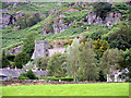
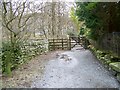
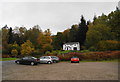
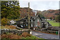
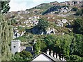
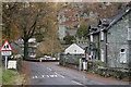
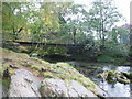
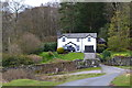
Photos of LA22 9JD


Area Information
Living in LA22 9JD offers a quiet, low-density lifestyle in a small residential cluster nestled in England. The area covers 813 square metres and is home to 1,291 people, with a population density of just 15 people per square kilometre. This suggests a rural or semi-rural setting, where space is abundant and community interactions are likely to be close-knit. The area’s proximity to ferry landings and local shops provides practical access to essentials, while the lack of major planning constraints means development pressures are minimal. Daily life here is likely to revolve around local amenities, seasonal activities, and a slower pace compared to urban centres. The presence of two primary schools with good Ofsted ratings adds to the appeal for families, though the area’s small size means services are limited to immediate needs. For those seeking a peaceful, low-traffic environment with a distinct sense of place, LA22 9JD offers a blend of practicality and tranquillity.
- Area Type
- Postcode
- Area Size
- 813 m²
- Population
- 1291
- Population Density
- 15 people/km²
The property market in LA22 9JD is shaped by its small size and predominantly residential nature. With 46% of homes owner-occupied, the area leans more towards rental properties, which may be influenced by its limited housing stock and rural setting. The accommodation type is exclusively houses, suggesting a lack of apartments or flats, which could appeal to those seeking space and privacy. However, the small population and low density mean the housing market is unlikely to be competitive or rapidly growing. Buyers should consider that the area’s size restricts the availability of properties, and the focus on single-family homes may limit options for those seeking alternative housing types. For those prioritising a quiet, low-traffic environment with established homes, LA22 9JD offers a niche market, but demand is likely to be niche as well.
House Prices in LA22 9JD
Showing 4 properties
| Address | Type | Beds | Baths | Last Sale Price | Last Sale Date | |
|---|---|---|---|---|---|---|
| Ghyllside, Langdale Estate, Elterwater, Ambleside, LA22 9JD | Unknown | - | - | - | - | |
| Woodside, Langdale Estate, Elterwater, Ambleside, LA22 9JD | Unknown | - | - | - | - | |
| Langdale Leisure Ltd, Great Langdale, Ambleside, LA22 9JD | Bungalow | - | - | - | - | |
| Flat, The Heading Mill, Elterwater, Ambleside, LA22 9JD | Flat | - | - | - | - |
Energy Efficiency in LA22 9JD
The lifestyle in LA22 9JD is defined by its access to practical amenities within close reach. Residents can find five retail outlets, including Co-op Grasmere, Budgens Ambleside, and Langdale Co-operative Society, offering essentials like groceries and household items. Nearby ferry landings, such as Wrey Castle Ferry Terminal and Monk Coniston Ferry Landing, provide connections to surrounding areas, enhancing mobility for leisure or commuting. While the area lacks large shopping centres or entertainment venues, the presence of these smaller-scale amenities supports a self-sufficient, community-oriented lifestyle. The low population density and rural setting likely encourage outdoor activities, though specific parks or recreational spaces are not detailed in the data. For those valuing convenience and a slower pace, the combination of local shops, ferry access, and proximity to natural landscapes offers a balanced, low-stress environment.
Amenities
Schools
Residents of LA22 9JD have access to two primary schools: Grasmere CofE Primary School and Langdale CofE School. Both institutions hold a ‘good’ Ofsted rating, reflecting their quality of education and standards of care. The presence of two primary schools within the area provides families with options for their children’s early education, though the lack of secondary schools nearby may necessitate travel for older students. The schools’ religious affiliations suggest a community with diverse cultural and educational values. For families prioritising strong local schools, this area offers a reliable foundation, but parents should consider the need for additional transport arrangements for secondary education. The proximity of these schools to homes underscores the area’s appeal for families seeking a stable, community-focused environment.
| Rank | School | Type | Entry gender | Ages |
|---|
Explore more schools in this area
Go to Schools tabDemographics
The community in LA22 9JD is predominantly composed of adults aged 30–64, with a median age of 47. This suggests a mature population, possibly with long-term ties to the area. Home ownership rates stand at 46%, indicating that nearly half of residents rent their homes, which may reflect the area’s smaller size and limited housing stock. The accommodation type is primarily houses, which aligns with the low population density and rural character. The predominant ethnic group is White, though no specific data on diversity or deprivation is provided. With a population of 1,291, the area is small enough to foster familiarity among residents but lacks the scale of larger towns. The demographic profile implies a stable, established community with a focus on family-oriented living, supported by local schools and nearby amenities.
Household Size
Accommodation Type
Tenure
Ethnic Group
Religion
Household Composition
Age
Household Deprivation
NS-SEC
Explore more demographic insights in this area
Go to Demographics tabPlanning
Planning Constraints
- Flood RiskPremium
- Ramsar Wetland SitesPremium
- Area of Outstanding Natural BeautyPremium
- Protected Nature ReservePremium
- Protected WoodlandPremium