Area Overview for LA22 9EU
Photos of LA22 9EU
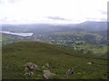
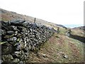
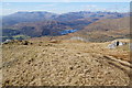
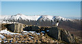
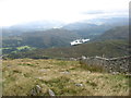
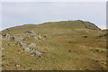
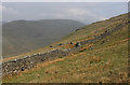

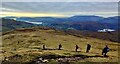
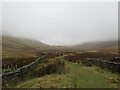
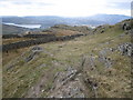
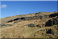
23 photos from this area
Area Information
Key information about the LA22 9EU including its size, population, and administrative classification.
- Area Type
- Postcode
- Area Size
- 8.5 km²
- Population
- 1412
- Population Density
- 35 people/km²
House Prices in LA22 9EU
19
Properties
£796,833
Average Sold Price
£308,500
Lowest Price
£1,600,000
Highest Price
Showing 19 properties
| Address | Type | Beds | Baths | Last Sale Price | Last Sale Date | |
|---|---|---|---|---|---|---|
| Dove Cottage, Ellerigg Road, Ambleside, LA22 9EU | house | 2 | 1 | £308,500 | May 2022 | |
| Ellerside, Ellerigg Road, Ambleside, LA22 9EU | house | - | - | £750,000 | Jun 2019 | |
| Ellerholme, Ellerigg Road, Ambleside, LA22 9EU | house | - | - | £1,250,000 | Jun 2017 | |
| Hope Cottage, Ellerigg Road, Ambleside, LA22 9EU | Detached | 5 | 4 | £542,500 | Mar 2016 | |
| Ellerhow, Ellerigg Road, Ambleside, LA22 9EU | house | - | - | £1,600,000 | Jul 2010 | |
| Ellerbank, Ellerigg Road, Ambleside, LA22 9EU | house | - | - | £330,000 | May 2002 | |
| Red Screes, Ellerthwaite House, Ellerigg Road, Ambleside, LA22 9EU | Flat | 1 | 1 | - | - | |
| Lake View, Ellerthwaite House, Ellerigg Road, Ambleside, LA22 9EU | Semi-detached | 4 | 3 | - | - | |
| Kirkstone, Ellerthwaite House, Ellerigg Road, Ambleside, LA22 9EU | Flat | - | - | - | - | |
| Wansfell, Ellerthwaite House, Ellerigg Road, Ambleside, LA22 9EU | Flat | - | - | - | - |
Page 1 of 2
Energy Efficiency in LA22 9EU
Amenities
Schools
| Rank | School | Type | Entry gender | Ages |
|---|
Explore more schools in this area
Go to Schools tabDemographics
Household Size
Two person
most common
Accommodation Type
Houses
most common
Tenure
64
majority
Ethnic Group
White
most common
Religion
N/A
most common
Household Composition
N/A
most common
Age
47
median
Adults (30-64 years)
most common
Household Deprivation
N/A
with no deprivation
NS-SEC
37
in Lower managerial occupations
Explore more demographic insights in this area
Go to Demographics tabPlanning
Planning Constraints
- Flood RiskPremium
- Ramsar Wetland SitesPremium
- Area of Outstanding Natural BeautyPremium
- Protected Nature ReservePremium
- Protected WoodlandPremium