Area Overview for LA22 9DH
Photos of LA22 9DH
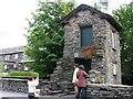

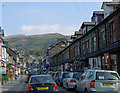
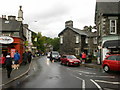
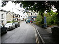
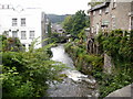
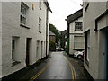
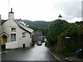
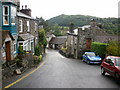
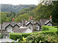
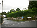
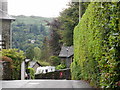
100 photos from this area
Area Information
Key information about the LA22 9DH including its size, population, and administrative classification.
- Area Type
- Postcode
- Area Size
- 2.1 hectares
- Population
- 1577
- Population Density
- 1289 people/km²
House Prices in LA22 9DH
9
Properties
£317,500
Average Sold Price
£125,000
Lowest Price
£510,000
Highest Price
Showing 9 properties
| Address | Type | Beds | Baths | Last Sale Price | Last Sale Date | |
|---|---|---|---|---|---|---|
| Park View, Vicarage Road, Ambleside, LA22 9DH | Terraced | 5 | 3 | £510,000 | Mar 2024 | |
| Church View, Vicarage Road, Ambleside, LA22 9DH | Flat | - | - | £125,000 | Apr 2018 | |
| Toilets Next To St Marys Church, Vicarage Road, Ambleside, LA22 9DH | commercial | - | - | - | - | |
| Owners Accommodation, Old Vicarage, Vicarage Road, Ambleside, LA22 9DH | hotel | - | - | - | - | |
| Conway, Vicarage Road, Ambleside, LA22 9DH | Terraced | - | - | - | - | |
| Newlyn, Vicarage Road, Ambleside, LA22 9DH | Terraced | - | - | - | - | |
| Corner View, Vicarage Road, Ambleside, LA22 9DH | Terraced | - | - | - | - | |
| Cranford, Vicarage Road, Ambleside, LA22 9DH | Flat | - | - | - | - | |
| 2 Vicarage Road, Ambleside, LA22 9DH | Terraced | - | - | - | - |
Energy Efficiency in LA22 9DH
Amenities
Schools
| Rank | School | Type | Entry gender | Ages |
|---|
Explore more schools in this area
Go to Schools tabDemographics
Household Size
One person
most common
Accommodation Type
Houses
most common
Tenure
46
majority
Ethnic Group
White
most common
Religion
N/A
most common
Household Composition
N/A
most common
Age
47
median
Adults (30-64 years)
most common
Household Deprivation
N/A
with no deprivation
NS-SEC
23
in Lower managerial occupations
Explore more demographic insights in this area
Go to Demographics tabPlanning
Planning Constraints
- Flood RiskPremium
- Ramsar Wetland SitesPremium
- Area of Outstanding Natural BeautyPremium
- Protected Nature ReservePremium
- Protected WoodlandPremium