Area Overview for LA22 0TZ
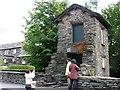
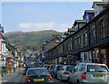
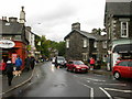
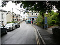
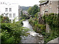
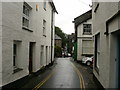
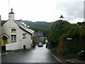
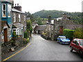
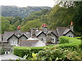
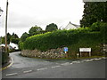
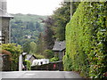
Photos of LA22 0TZ

Area Information
Living in LA22 0TZ means being part of a small, tightly knit residential cluster in England. With a population of 1,412 and a density of 35 people per square kilometre, this area offers a quiet, low-density lifestyle. The community is predominantly composed of adults aged 30–64, reflecting a mature demographic that values stability. Daily life here is shaped by proximity to natural and practical amenities. The postcode’s small size means residents are likely to know their neighbours, and the area’s character is defined by its blend of residential calm and accessible services. Nearby, the Windermere School provides an independent education option, while local shops and ferry landings ensure everyday needs are met without long commutes. The area’s low flood risk and absence of protected natural sites suggest a straightforward planning environment, though its modest size means it is best suited for those prioritising community over urban sprawl. For buyers seeking a peaceful, family-friendly setting with a manageable population, LA22 0TZ offers a distinct alternative to larger towns.
- Area Type
- Postcode
- Area Size
- Not available
- Population
- 1412
- Population Density
- 35 people/km²
The property market in LA22 0TZ is dominated by owner-occupied homes, with 64% of properties owned by residents rather than rented. This suggests a stable, long-term residential base, likely attracting buyers seeking a settled lifestyle. The predominant accommodation type is houses, which aligns with the area’s low density and emphasis on private, spacious living. For buyers, this means a market where larger homes are more common than flats or apartments, catering to families or individuals prioritising space. The small size of the area means the housing stock is limited, potentially making it a competitive market for those seeking properties in the immediate vicinity. The absence of rental-focused developments implies that investment opportunities may be more about long-term ownership than short-term lettings. Buyers should consider the area’s small scale when assessing availability and potential for future growth.
House Prices in LA22 0TZ
No properties found in this postcode.
Energy Efficiency in LA22 0TZ
Residents of LA22 0TZ have access to a range of nearby amenities that support daily life. The retail sector includes five venues, such as Tesco Ambleside, Budgens Ambleside, and Spar, offering convenience for grocery shopping and essential purchases. These shops are within practical reach, reducing the need for long journeys to larger towns. The area’s ferry landings, including Ambleside Waterhead Ferry Landing and Wrey Castle Ferry Terminal, provide access to water transport, which can be useful for commuting or leisure activities. While the data does not specify additional leisure or recreational facilities, the presence of multiple ferry points suggests the area is well-connected to natural or scenic environments. The combination of local shops and transport links creates a lifestyle that balances practicality with access to regional mobility.
Amenities
Schools
The nearest school to LA22 0TZ is Windermere School, an independent institution. While no Ofsted rating is provided, its independent status indicates it may cater to families seeking alternative education models outside the state system. The presence of one independent school suggests a niche appeal for households prioritising private education. However, the data does not include state schools or additional educational facilities, meaning families may need to look further afield for comprehensive schooling options. For those valuing independent education, Windermere School offers a dedicated resource, but the area’s limited school infrastructure means broader educational choices are not immediately available.
| Rank | School | Type | Entry gender | Ages |
|---|
Explore more schools in this area
Go to Schools tabDemographics
The community in LA22 0TZ is predominantly composed of adults aged 30–64, with a median age of 47. This suggests a mature, established population, likely with long-term ties to the area. Home ownership is high at 64%, indicating a strong presence of owner-occupied properties. The accommodation type is primarily houses, reflecting a residential area with larger, more private living spaces. The predominant ethnic group is White, aligning with broader trends in the region. The population density of 35 people per square kilometre implies a low-pressure, spacious living environment. While no specific deprivation data is provided, the age profile and ownership rates suggest a community with relatively stable economic conditions. The absence of detailed diversity metrics means the area’s social composition is not extensively characterised, but the data highlights a cohesive, middle-aged demographic with a focus on homeownership.
Household Size
Accommodation Type
Tenure
Ethnic Group
Religion
Household Composition
Age
Household Deprivation
NS-SEC
Explore more demographic insights in this area
Go to Demographics tabPlanning
Planning Constraints
- Flood RiskPremium
- Ramsar Wetland SitesPremium
- Area of Outstanding Natural BeautyPremium
- Protected Nature ReservePremium
- Protected WoodlandPremium