Area Overview for LA22 0LP
Photos of LA22 0LP
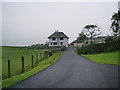
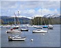
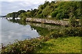
![Walk around Claife Heights [71] in LA22 0LP](https://images.propbar.co.uk/images/geograph/62/20/6220789_120.jpg)
94 photos from this area
Area Information
Key information about the LA22 0LP including its size, population, and administrative classification.
- Area Type
- Postcode
- Area Size
- 8040 m²
- Population
- 1847
- Population Density
- 92 people/km²
House Prices in LA22 0LP
2
Properties
-
Average Sold Price
-
Lowest Price
-
Highest Price
Showing 2 properties
| Address | Type | Beds | Baths | Last Sale Price | Last Sale Date | |
|---|---|---|---|---|---|---|
| The Annexe, Ferry House, Access Road To The Ferry House From The B 5285, Far Sawrey, LA22 0LP | Flat | - | - | - | - | |
| Freshwater Biological Organisation, Hatchery, The Ferry Landing, Far Sawrey, Ambleside, LA22 0LP | Office | - | - | - | - |
Energy Efficiency in LA22 0LP
Amenities
Schools
| Rank | School | Type | Entry gender | Ages |
|---|
Explore more schools in this area
Go to Schools tabDemographics
Household Size
Two person
most common
Accommodation Type
Houses
most common
Tenure
57
majority
Ethnic Group
White
most common
Religion
N/A
most common
Household Composition
N/A
most common
Age
47
median
Adults (30-64 years)
most common
Household Deprivation
N/A
with no deprivation
NS-SEC
38
in Lower managerial occupations
Explore more demographic insights in this area
Go to Demographics tabPlanning
Planning Constraints
- Flood RiskPremium
- Ramsar Wetland SitesPremium
- Area of Outstanding Natural BeautyPremium
- Protected Nature ReservePremium