Area Overview for LA22 0LB
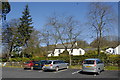
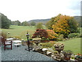
Photos of LA22 0LB
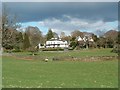
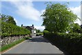
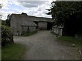
![Near Sawrey houses [7] in LA22 0LB](https://images.propbar.co.uk/images/geograph/62/23/6223408_120.jpg)
87 photos from this area
Area Information
Key information about the LA22 0LB including its size, population, and administrative classification.
- Area Type
- Postcode
- Area Size
- 33.1 hectares
- Population
- 1395
- Population Density
- 15 people/km²
House Prices in LA22 0LB
11
Properties
£377,050
Average Sold Price
£134,100
Lowest Price
£620,000
Highest Price
Showing 11 properties
| Address | Type | Beds | Baths | Last Sale Price | Last Sale Date | |
|---|---|---|---|---|---|---|
| Low House, Near Sawrey, Ambleside, LA22 0LB | Detached | 3 | - | £620,000 | Sep 2019 | |
| Woodleigh, Near Sawrey, Ambleside, LA22 0LB | Terraced | - | - | £134,100 | Aug 1998 | |
| 1A, Lakefield Cottages, Near Sawrey, Ambleside, LA22 0LB | house | - | - | - | - | |
| Esthwaite How Farmhouse, Near Sawrey, Ambleside, LA22 0LB | Farm | 4 | 3 | - | - | |
| Sunnyside, Near Sawrey, Ambleside, LA22 0LB | house | - | - | - | - | |
| 1, Brockbank Cottage, Lakefield Cottages, Near Sawrey, Ambleside, LA22 0LB | house | - | - | - | - | |
| 2, Lakefield Cottages, Near Sawrey, Ambleside, LA22 0LB | house | - | - | - | - | |
| 3, Lakefield Cottages, Near Sawrey, Ambleside, LA22 0LB | house | - | - | - | - | |
| Coach House, Near Sawrey, Ambleside, LA22 0LB | house | - | - | - | - | |
| Twitchet, Near Sawrey, Ambleside, LA22 0LB | Detached | - | - | - | - |
Page 1 of 2
Energy Efficiency in LA22 0LB
Amenities
Schools
| Rank | School | Type | Entry gender | Ages |
|---|
Explore more schools in this area
Go to Schools tabDemographics
Household Size
Two person
most common
Accommodation Type
Houses
most common
Tenure
60
majority
Ethnic Group
White
most common
Religion
N/A
most common
Household Composition
N/A
most common
Age
47
median
Adults (30-64 years)
most common
Household Deprivation
N/A
with no deprivation
NS-SEC
37
in Lower managerial occupations
Explore more demographic insights in this area
Go to Demographics tabPlanning
Planning Constraints
- Flood RiskPremium
- Ramsar Wetland SitesPremium
- Area of Outstanding Natural BeautyPremium
- Protected Nature ReservePremium