Area Overview for LA22 0HT
Photos of LA22 0HT
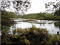
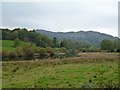
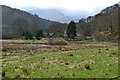
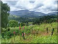
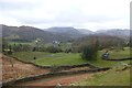
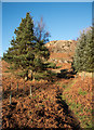
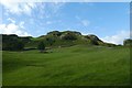

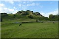
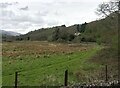
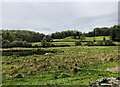
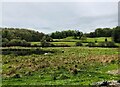
41 photos from this area
Area Information
Key information about the LA22 0HT including its size, population, and administrative classification.
- Area Type
- Postcode
- Area Size
- 73.3 hectares
- Population
- 1546
- Population Density
- 14 people/km²
House Prices in LA22 0HT
13
Properties
£890,375
Average Sold Price
£280,000
Lowest Price
£1,790,000
Highest Price
Showing 13 properties
| Address | Type | Beds | Baths | Last Sale Price | Last Sale Date | |
|---|---|---|---|---|---|---|
| Hillcrest, Skelwith Fold, Ambleside, LA22 0HT | Detached | 5 | 3 | £1,790,000 | Apr 2022 | |
| 3, SKELWITH FOLD COTTAGES, SKELWITH FOLD, Ambleside, LA22 0HT | Detached | 2 | - | £700,000 | Dec 2020 | |
| Crop How, Skelwith Fold, Ambleside, LA22 0HT | Bungalow | - | - | £791,500 | Apr 2020 | |
| 2, Skelwith Fold Cottages, Skelwith Fold, Ambleside, LA22 0HT | Terraced | - | - | £280,000 | Jun 2005 | |
| Old Farm Cottage, Skelwith Fold, Ambleside, LA22 0HT | house | - | - | - | - | |
| Manor House, Skelwith Fold, Ambleside, LA22 0HT | Terraced | - | - | - | - | |
| Pine Trees, Skelwith Fold, Ambleside, LA22 0HT | Detached | - | - | - | - | |
| Rocklands, Skelwith Fold Farm, Skelwith Fold, Ambleside, LA22 0HT | Bungalow | 2 | 1 | - | - | |
| Manor Cottage, Skelwith Fold, Ambleside, LA22 0HT | Terraced | - | - | - | - | |
| Skelwith Fold Farm, Skelwith Fold, Ambleside, LA22 0HT | house | - | - | - | - |
Page 1 of 2
Energy Efficiency in LA22 0HT
Amenities
Schools
| Rank | School | Type | Entry gender | Ages |
|---|
Explore more schools in this area
Go to Schools tabDemographics
Household Size
Two person
most common
Accommodation Type
Houses
most common
Tenure
66
majority
Ethnic Group
White
most common
Religion
N/A
most common
Household Composition
N/A
most common
Age
47
median
Adults (30-64 years)
most common
Household Deprivation
N/A
with no deprivation
NS-SEC
35
in Lower managerial occupations
Explore more demographic insights in this area
Go to Demographics tabPlanning
Planning Constraints
- Flood RiskPremium
- Ramsar Wetland SitesPremium
- Area of Outstanding Natural BeautyPremium
- Protected Nature ReservePremium
- Protected WoodlandPremium