Area Overview for LA22 0HD
Photos of LA22 0HD
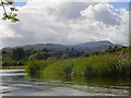
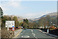
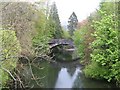
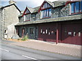
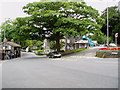
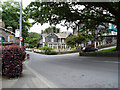

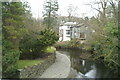
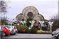
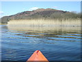
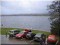
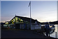
100 photos from this area
Area Information
Key information about the LA22 0HD including its size, population, and administrative classification.
- Area Type
- Postcode
- Area Size
- 5.8 hectares
- Population
- 1412
- Population Density
- 35 people/km²
House Prices in LA22 0HD
24
Properties
£403,600
Average Sold Price
£270,000
Lowest Price
£645,000
Highest Price
Showing 24 properties
| Address | Type | Beds | Baths | Last Sale Price | Last Sale Date | |
|---|---|---|---|---|---|---|
| 5, Romney Grange, Waterhead, Ambleside, LA22 0HD | house | - | - | £290,000 | Oct 2016 | |
| 28, Romney Grange, Waterhead, Ambleside, LA22 0HD | Flat | - | - | £376,500 | Sep 2015 | |
| 23, Romney Grange, Waterhead, Ambleside, LA22 0HD | Flat | 3 | 2 | £270,000 | Jun 2014 | |
| High Ghyll, Waterhead, Ambleside, LA22 0HD | Bungalow | 3 | - | £645,000 | Feb 2014 | |
| 18, Romney Grange, Waterhead, Ambleside, LA22 0HD | Flat | - | - | £550,000 | Aug 2012 | |
| 19, Romney Grange, Waterhead, Ambleside, LA22 0HD | Flat | - | - | £348,000 | Jul 2012 | |
| 7, Romney Grange, Waterhead, Ambleside, LA22 0HD | Flat | - | - | £295,000 | Jul 2011 | |
| 6, Romney Grange, Waterhead, Ambleside, LA22 0HD | Flat | - | - | £490,000 | Mar 2010 | |
| 24, Romney Grange, Waterhead, Ambleside, LA22 0HD | Flat | - | - | £364,500 | Oct 2007 | |
| 8, Romney Grange, Waterhead, Ambleside, LA22 0HD | Flat | - | - | £407,000 | Jul 2007 |
Page 1 of 3
Energy Efficiency in LA22 0HD
Amenities
Schools
| Rank | School | Type | Entry gender | Ages |
|---|
Explore more schools in this area
Go to Schools tabDemographics
Household Size
Two person
most common
Accommodation Type
Houses
most common
Tenure
64
majority
Ethnic Group
White
most common
Religion
N/A
most common
Household Composition
N/A
most common
Age
47
median
Adults (30-64 years)
most common
Household Deprivation
N/A
with no deprivation
NS-SEC
37
in Lower managerial occupations
Explore more demographic insights in this area
Go to Demographics tabPlanning
Planning Constraints
- Flood RiskPremium
- Ramsar Wetland SitesPremium
- Area of Outstanding Natural BeautyPremium
- Protected Nature ReservePremium
- Protected WoodlandPremium