Area Overview for LA20 6DY
Photos of LA20 6DY
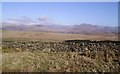

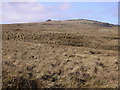
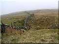
4 photos from this area
Area Information
Key information about the LA20 6DY including its size, population, and administrative classification.
- Area Type
- Postcode
- Area Size
- 15.7 km²
- Population
- 1276
- Population Density
- 9 people/km²
House Prices in LA20 6DY
12
Properties
-
Average Sold Price
-
Lowest Price
-
Highest Price
Showing 12 properties
| Address | Type | Beds | Baths | Last Sale Price | Last Sale Date | |
|---|---|---|---|---|---|---|
| WOODEND BARN, ULPHA, Ulpha, LA20 6DY | Detached | - | - | - | - | |
| Hazel Head Cottage, Ulpha, Ulpha, LA20 6DY | Detached | - | - | - | - | |
| Baskill Farm, Ulpha, Ulpha, LA20 6DY | Semi-detached | - | - | - | - | |
| Crosbythwaite Farm, Ulpha, Ulpha, LA20 6DY | house | - | - | - | - | |
| Brigg House, Ulpha, Ulpha, LA20 6DY | Detached | - | - | - | - | |
| Booth Holme, Duddon Bridge To Hall Dunnerdale Road, Ulpha, LA20 6DY | Detached | - | - | - | - | |
| Brigg House Cottage, Ulpha, Ulpha, LA20 6DY | hotel | - | - | - | - | |
| Woodend Schoolhouse, Woodend Barn, Access Road To Woodend From The U 4275, Ulpha, LA20 6DY | Bungalow | - | - | - | - | |
| Woodend Bothy, Woodend Barn, Access Road To Woodend From The U 4275, Ulpha, LA20 6DY | hotel | - | - | - | - | |
| The Buttery, Woodend Barn, Access Road To Woodend From The U 4275, Ulpha, LA20 6DY | hotel | - | - | - | - |
Page 1 of 2
Energy Efficiency in LA20 6DY
Amenities
Schools
| Rank | School | Type | Entry gender | Ages |
|---|
Explore more schools in this area
Go to Schools tabDemographics
Household Size
Two person
most common
Accommodation Type
Houses
most common
Tenure
86
majority
Ethnic Group
White
most common
Religion
N/A
most common
Household Composition
N/A
most common
Age
47
median
Adults (30-64 years)
most common
Household Deprivation
N/A
with no deprivation
NS-SEC
38
in Lower managerial occupations
Explore more demographic insights in this area
Go to Demographics tabPlanning
Planning Constraints
- Flood RiskPremium
- Ramsar Wetland SitesPremium
- Area of Outstanding Natural BeautyPremium
- Protected Nature ReservePremium
- Protected WoodlandPremium