Area Overview for LA18 4GF
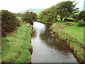
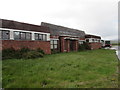
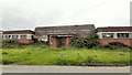
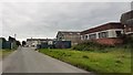
Photos of LA18 4GF


Area Information
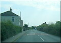
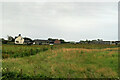
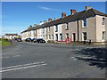
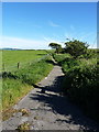
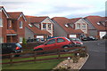
Living in LA18 4GF means being part of a small, tightly knit residential cluster in England. With a population of 1,461 people spread across 332 residents per square kilometre, this area offers a quiet, low-density lifestyle. The community is predominantly composed of adults aged 30–64, reflecting a mature demographic with strong home ownership. Most properties are houses, contributing to a sense of stability and permanence. The area’s proximity to rail networks, including Millom and Silecroft stations, ensures easy access to nearby towns. While the broadband score is poor, mobile coverage is good, supporting remote work and daily connectivity. LA18 4GF is ideal for those seeking a peaceful, family-oriented environment with minimal environmental constraints. Its small size means residents know their neighbours, and the absence of protected natural sites or flood risks adds to its practical appeal. For buyers, this postcode represents a straightforward, low-maintenance living option with clear infrastructure and a defined community character.
- Area Type
- Postcode
- Area Size
- Not available
- Population
- 1461
- Population Density
- 332 people/km²
The property market in LA18 4GF is characterised by high home ownership (77%) and a predominance of houses. This suggests a market skewed towards owner-occupied properties rather than rental units, which is typical of smaller, rural or semi-rural postcode areas. The limited population and low density mean the housing stock is likely to be modest in scale, with fewer high-rise developments or large estates. For buyers, this presents a straightforward market with clear ownership patterns, but the small size of the area may limit the range of properties available. The focus on houses rather than flats or apartments indicates a preference for traditional, family-friendly homes. Prospective buyers should consider the area’s proximity to rail links and its low environmental risk factors, which could enhance long-term value.
House Prices in LA18 4GF
No properties found in this postcode.
Energy Efficiency in LA18 4GF
Residents of LA18 4GF have access to a range of local amenities within easy reach. The area includes five retail outlets, such as Spar, Tesco Millom, and Co-op Askam, ensuring everyday shopping needs are met. Rail connectivity is strong, with five stations—Millom, Silecroft, and Green Road—providing links to nearby towns and transport hubs. The proximity to Barrow Walney Island Airport adds to the area’s accessibility for regional and national travel. While the number of amenities is modest, their variety and placement suggest a convenient lifestyle for residents. The presence of multiple retail and transport options supports a practical, community-focused daily life, with minimal reliance on long-distance travel for essentials.
Amenities
Schools
| Rank | School | Type | Entry gender | Ages |
|---|
Explore more schools in this area
Go to Schools tabDemographics
The demographic profile of LA18 4GF is defined by its mature population, with a median age of 47 and the majority of residents falling within the 30–64 age range. This suggests a community of established professionals and families, with fewer young people or retirees. Home ownership is high at 77%, indicating a stable, long-term resident base. The predominant accommodation type is houses, which aligns with the area’s low-density layout. The predominant ethnic group is White, reflecting a homogenous demographic. While no specific data on deprivation is provided, the high home ownership rate and absence of planning constraints suggest a relatively stable quality of life. The age profile implies a community focused on maintaining property value and local amenities, with fewer pressures from student populations or transient renters.
Household Size
Accommodation Type
Tenure
Ethnic Group
Religion
Household Composition
Age
Household Deprivation
NS-SEC
Explore more demographic insights in this area
Go to Demographics tabPlanning
Planning Constraints
- Flood RiskPremium
- Ramsar Wetland SitesPremium
- Area of Outstanding Natural BeautyPremium
- Protected Nature ReservePremium
- Protected WoodlandPremium