Area Overview for LA16 7BN
Photos of LA16 7BN
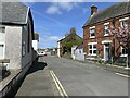
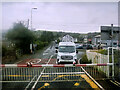
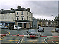
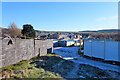
22 photos from this area
Area Information
Key information about the LA16 7BN including its size, population, and administrative classification.
- Area Type
- Postcode
- Area Size
- 1.2 hectares
- Population
- 1985
- Population Density
- 2960 people/km²
House Prices in LA16 7BN
59
Properties
£68,341
Average Sold Price
£8,500
Lowest Price
£115,000
Highest Price
Showing 59 properties
| Address | Type | Beds | Baths | Last Sale Price | Last Sale Date | |
|---|---|---|---|---|---|---|
| 61 Sharp Street, Askam In Furness, LA16 7BN | Terraced | 2 | 2 | £110,000 | Jan 2025 | |
| 43 Sharp Street, Askam In Furness, LA16 7BN | Terraced | 3 | 1 | £93,000 | Dec 2024 | |
| 10 Sharp Street, Askam In Furness, LA16 7BN | Terraced | 2 | 1 | £89,950 | Oct 2023 | |
| 52 Sharp Street, Askam In Furness, LA16 7BN | Terraced | 3 | 1 | £115,000 | Jun 2023 | |
| 32 Sharp Street, Askam In Furness, LA16 7BN | Terraced | 3 | 1 | £112,000 | Mar 2023 | |
| 75 Sharp Street, Askam In Furness, LA16 7BN | house | - | - | £70,000 | Feb 2023 | |
| 51 Sharp Street, Askam In Furness, LA16 7BN | Retail | 2 | 1 | £113,500 | Dec 2022 | |
| 45 Sharp Street, Askam In Furness, LA16 7BN | Terraced | 2 | - | £110,000 | Jul 2022 | |
| 20 Sharp Street, Askam In Furness, LA16 7BN | house | - | - | £115,000 | May 2022 | |
| 73 Sharp Street, Askam In Furness, LA16 7BN | house | - | - | £107,000 | Feb 2022 |
Page 1 of 6
Energy Efficiency in LA16 7BN
Amenities
Schools
| Rank | School | Type | Entry gender | Ages |
|---|
Explore more schools in this area
Go to Schools tabDemographics
Household Size
Two person
most common
Accommodation Type
Houses
most common
Tenure
87
majority
Ethnic Group
White
most common
Religion
N/A
most common
Household Composition
N/A
most common
Age
47
median
Adults (30-64 years)
most common
Household Deprivation
N/A
with no deprivation
NS-SEC
31
in Lower managerial occupations
Explore more demographic insights in this area
Go to Demographics tabPlanning
Planning Constraints
- Flood RiskPremium
- Ramsar Wetland SitesPremium
- Area of Outstanding Natural BeautyPremium
- Protected Nature ReservePremium
- Protected WoodlandPremium