Area Overview for LA15 8PH
Photos of LA15 8PH
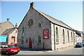

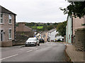
30 photos from this area
Area Information
Key information about the LA15 8PH including its size, population, and administrative classification.
- Area Type
- Postcode
- Area Size
- 1967 m²
- Population
- 1444
- Population Density
- 933 people/km²
House Prices in LA15 8PH
14
Properties
£109,450
Average Sold Price
£22,200
Lowest Price
£217,000
Highest Price
Showing 14 properties
| Address | Type | Beds | Baths | Last Sale Price | Last Sale Date | |
|---|---|---|---|---|---|---|
| 15 Garden Terrace, Dalton In Furness, LA15 8PH | Terraced | 3 | 1 | £217,000 | Jun 2023 | |
| 17 Garden Terrace, Dalton In Furness, LA15 8PH | house | - | - | £215,000 | Mar 2023 | |
| 33 Garden Terrace, Dalton In Furness, LA15 8PH | house | - | - | £62,000 | Jul 2021 | |
| The Barn, Garden Terrace, Dalton In Furness, LA15 8PH | house | 2 | - | £78,000 | Jul 2014 | |
| 31 Garden Terrace, Dalton In Furness, LA15 8PH | Flat | 2 | 1 | £22,200 | Jul 2003 | |
| 21 Garden Terrace, Dalton In Furness, LA15 8PH | house | - | - | £59,950 | Jul 2003 | |
| 25 Garden Terrace, Dalton In Furness, LA15 8PH | Flat | - | - | £112,000 | May 1999 | |
| 23A Garden Terrace, Dalton In Furness, LA15 8PH | Terraced | 3 | 1 | - | - | |
| 27 Garden Terrace, Dalton In Furness, LA15 8PH | Unknown | - | - | - | - | |
| 29 Garden Terrace, Dalton In Furness, LA15 8PH | Unknown | - | - | - | - |
Page 1 of 2
Energy Efficiency in LA15 8PH
Amenities
Schools
| Rank | School | Type | Entry gender | Ages |
|---|
Explore more schools in this area
Go to Schools tabDemographics
Household Size
Two person
most common
Accommodation Type
Houses
most common
Tenure
78
majority
Ethnic Group
White
most common
Religion
N/A
most common
Household Composition
N/A
most common
Age
47
median
Adults (30-64 years)
most common
Household Deprivation
N/A
with no deprivation
NS-SEC
35
in Lower managerial occupations
Explore more demographic insights in this area
Go to Demographics tabPlanning
Planning Constraints
- Flood RiskPremium
- Ramsar Wetland SitesPremium
- Area of Outstanding Natural BeautyPremium
- Protected Nature ReservePremium
- Protected WoodlandPremium