Area Overview for LA14 5PG
Photos of LA14 5PG

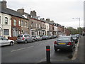
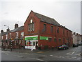
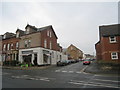
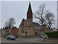
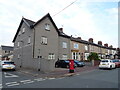
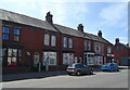

28 photos from this area
Area Information
Key information about the LA14 5PG including its size, population, and administrative classification.
- Area Type
- Postcode
- Area Size
- 7968 m²
- Population
- 1382
- Population Density
- 4521 people/km²
House Prices in LA14 5PG
18
Properties
£109,811
Average Sold Price
£42,950
Lowest Price
£255,000
Highest Price
Showing 18 properties
| Address | Type | Beds | Baths | Last Sale Price | Last Sale Date | |
|---|---|---|---|---|---|---|
| 7 Sandringham Close, Barrow In Furness, LA14 5PG | house | - | - | £165,000 | Apr 2024 | |
| 12 Sandringham Close, Barrow In Furness, LA14 5PG | Terraced | 2 | 1 | £165,000 | Oct 2023 | |
| 5 Sandringham Close, Barrow In Furness, LA14 5PG | house | - | - | £150,000 | Oct 2022 | |
| 4 Sandringham Close, Barrow In Furness, LA14 5PG | house | - | - | £207,500 | Sep 2021 | |
| 3 Sandringham Close, Barrow In Furness, LA14 5PG | Semi-detached | 3 | 2 | £255,000 | Jun 2021 | |
| 17 Sandringham Close, Barrow In Furness, LA14 5PG | Semi-detached | 3 | 1 | £175,000 | Oct 2018 | |
| 16 Sandringham Close, Barrow In Furness, LA14 5PG | house | - | - | £70,000 | Nov 2015 | |
| 14 Sandringham Close, Barrow In Furness, LA14 5PG | Terraced | 2 | 1 | £107,000 | Feb 2015 | |
| 9 Sandringham Close, Barrow In Furness, LA14 5PG | Terraced | - | - | £110,000 | Mar 2006 | |
| 6 Sandringham Close, Barrow In Furness, LA14 5PG | house | - | - | £84,950 | Dec 2003 |
Page 1 of 2
Energy Efficiency in LA14 5PG
Amenities
Schools
| Rank | School | Type | Entry gender | Ages |
|---|
Explore more schools in this area
Go to Schools tabDemographics
Household Size
Two person
most common
Accommodation Type
Houses
most common
Tenure
88
majority
Ethnic Group
White
most common
Religion
N/A
most common
Household Composition
N/A
most common
Age
47
median
Adults (30-64 years)
most common
Household Deprivation
N/A
with no deprivation
NS-SEC
39
in Lower managerial occupations
Explore more demographic insights in this area
Go to Demographics tabPlanning
Planning Constraints
- Flood RiskPremium
- Ramsar Wetland SitesPremium
- Area of Outstanding Natural BeautyPremium
- Protected Nature ReservePremium
- Protected WoodlandPremium