Area Overview for LA14 5PF
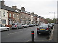
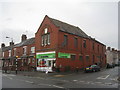
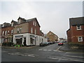
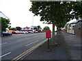
Photos of LA14 5PF


Area Information
Living in LA14 5PF means being part of a small, tightly knit residential cluster in England, where the population of 1230 residents reflects a quiet, stable community. This postcode area is characterised by its modest scale, with homes predominantly in the form of traditional houses. The area’s appeal lies in its low crime risk and minimal environmental constraints, making it a practical choice for those seeking safety and simplicity. Daily life here is shaped by proximity to essential services, including retail outlets like Co-op Ainslie and Tesco Rawlinson, and transport links such as Barrow and Roose railway stations. While the population is small, the area’s connectivity to nearby towns and natural features like Roa Island Ferry Landing ensures residents can access both urban and coastal amenities. LA14 5PF is not a place for those seeking a fast-paced lifestyle, but it offers a reliable, low-maintenance environment with a focus on practical living. Its compact size means neighbours are likely to be familiar faces, and the absence of major planning constraints allows for straightforward property transactions. For buyers prioritising safety, affordability, and a calm atmosphere, this area provides a straightforward proposition.
- Area Type
- Postcode
- Area Size
- Not available
- Population
- 1230
- Population Density
- Not available
The property market in LA14 5PF is defined by a high rate of home ownership—84%—and a focus on houses rather than flats or apartments. This suggests a community where property is primarily owner-occupied, with fewer rental properties available. The dominance of houses indicates a market catering to families or individuals seeking space and privacy, rather than urban living. Given the area’s small size and limited development constraints, the housing stock is likely to be older, with traditional builds that may require maintenance. Buyers should consider that the market is not large, meaning competition for properties may be limited but transactions could be slower due to the small pool of listings. The absence of planning restrictions like AONB or protected woodlands means developers have fewer barriers to building, though the area’s compact nature may restrict expansion. For those seeking a quiet, low-risk investment, LA14 5PF offers a straightforward market with predictable value retention, though it may not appeal to those prioritising modern or high-density housing.
House Prices in LA14 5PF
No properties found in this postcode.
Energy Efficiency in LA14 5PF
Residents of LA14 5PF have access to a range of amenities within practical reach, blending practicality with coastal charm. Retail options include Co-op Ainslie, Co-op Barrow-in-Furness, and Tesco Rawlinson, offering essentials and everyday shopping. The area’s rail network, with stations at Barrow, Roose, and Dalton, connects to broader regional transport systems, while Barrow Walney Island Airport provides regional flight access. For those seeking leisure, two ferry landings—Roa Island and Piel Island—open doors to nearby islands and coastal walks. Though the area is small, these amenities collectively support a self-sufficient lifestyle, with shops, transport, and natural attractions all within easy reach. The absence of large supermarkets or entertainment hubs means the area caters to those valuing convenience over variety, but the proximity to the coast and rural landscapes offers opportunities for outdoor activities. Daily life here is defined by simplicity, with amenities designed to meet basic needs rather than cater to niche interests.
Amenities
Schools
| Rank | School | Type | Entry gender | Ages |
|---|
Explore more schools in this area
Go to Schools tabDemographics
The community in LA14 5PF is predominantly composed of adults aged 30–64, with a median age of 47. This suggests a population skewed towards middle-aged individuals, many of whom may be in their prime working years or nearing retirement. Home ownership is exceptionally high at 84%, indicating a strong presence of long-term residents and a stable housing market. The area’s accommodation is almost exclusively houses, reflecting a preference for standalone properties over flats or apartments. The predominant ethnic group is White, which aligns with broader demographic trends in the region. While no specific data on deprivation or diversity is provided, the high home ownership rate and low crime risk suggest a community with relatively high economic stability. The absence of significant demographic diversity may mean fewer cultural amenities or services catering to a broader range of needs, but it also contributes to a cohesive, familiar social environment. For prospective buyers, this profile implies a neighbourhood where property values are likely to hold their worth, and the character of the area remains consistent over time.
Household Size
Accommodation Type
Tenure
Ethnic Group
Religion
Household Composition
Age
Household Deprivation
NS-SEC
Explore more demographic insights in this area
Go to Demographics tabPlanning
Planning Constraints
- Flood RiskPremium
- Ramsar Wetland SitesPremium
- Area of Outstanding Natural BeautyPremium
- Protected Nature ReservePremium
- Protected WoodlandPremium