Area Overview for LA14 4UA
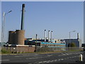
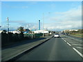
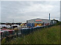
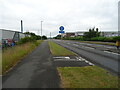
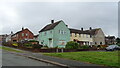
Photos of LA14 4UA


Area Information
Living in LA14 4UA offers a compact, residential lifestyle shaped by its small cluster of homes and proximity to essential services. With a population of 1,524 spread over 450 people per square kilometre, the area feels intimate yet connected. Situated in England, it lies within reach of coastal amenities and transport links, making it a practical choice for those prioritising accessibility. The community is anchored by local schools, rail stations, and retail hubs, ensuring daily needs are met without long commutes. While the area’s size limits sprawling development, its density supports a tight-knit environment. Residents benefit from nearby ferry routes to Roa and Piel Islands, as well as rail connections to Barrow and Dalton. The presence of multiple primary schools, including Ormsgill Infant and Junior Schools, underscores its appeal for families. However, the area’s compact nature means it is best suited for those seeking a straightforward, no-frills lifestyle rather than sprawling urban or rural landscapes.
- Area Type
- Postcode
- Area Size
- Not available
- Population
- 1524
- Population Density
- 450 people/km²
The property market in LA14 4UA is characterised by a 35% home ownership rate, indicating that the majority of housing stock is rented out rather than owner-occupied. This suggests a rental market with limited opportunities for buyers seeking to purchase a primary residence. The predominant accommodation type is houses, which may appeal to families or those preferring standalone properties. However, the low home ownership rate could signal limited availability of buy-to-let opportunities or a high turnover of rental properties. For buyers, this small area’s housing stock may be constrained by its size, with limited scope for expansion or new developments. The focus on houses rather than flats or apartments may also mean that property prices are influenced by the cost of maintaining larger homes, which could be a consideration for potential purchasers. Those looking to invest in the area may need to assess the long-term viability of rental returns given the existing market dynamics.
House Prices in LA14 4UA
No properties found in this postcode.
Energy Efficiency in LA14 4UA
The lifestyle in LA14 4UA is shaped by its proximity to retail, transport, and leisure options. Local shops include Spar Barrow, Co-op Barrow-in-Furness, and Asda Barrow, offering everyday essentials within practical reach. These stores cater to both routine shopping and larger grocery needs, reducing the need for long trips. The area’s rail stations connect to broader networks, while ferry landings at Roa and Piel Islands provide access to coastal destinations. The Barrow Walney Island Airport, though modest, adds to regional connectivity. For leisure, the nearby islands may offer recreational opportunities, though specific facilities are not detailed. The combination of retail, transport, and coastal access creates a lifestyle that balances convenience with limited local amenities, making it suitable for those prioritising accessibility over sprawling urban or rural environments.
Amenities
Schools
Residents of LA14 4UA have access to multiple primary schools, including Ormsgill Infant School, Ormsgill Junior School, and Ormsgill Nursery and Primary School. These institutions cater to early years education through primary-level learning, providing a range of options for families. The repetition of Ormsgill Nursery and Primary School in the data may indicate a consolidation of services or a naming oversight, but the presence of multiple schools suggests a focus on primary education in the area. For families, this cluster of schools offers convenience, though the absence of secondary schools nearby means students will need to travel for further education. The availability of primary schools is a key draw for families, but the lack of data on Ofsted ratings or academic performance means the quality of education remains unverified. Parents should investigate further to assess how these schools align with their children’s needs.
| Rank | School | Type | Entry gender | Ages |
|---|
Explore more schools in this area
Go to Schools tabDemographics
The demographic profile of LA14 4UA reflects a mature population, with a median age of 47 and the majority of residents falling within the 30-64 age range. This suggests a community centred around working-age adults and families, though retirement may also play a role. Home ownership rates stand at 35%, indicating a rental-heavy market where many residents live in properties they do not own. The predominant accommodation type is houses, which contrasts with higher-density areas dominated by flats. The population is predominantly White, with no data provided on other ethnic groups. This homogeneity may influence the social dynamics and cultural offerings of the area. The relatively low home ownership rate could reflect economic factors or a preference for rental flexibility, though it may also impact long-term stability for buyers. The absence of specific deprivation data means the quality of life implications of these figures remain unquantified, but the age profile suggests a balance between active professionals and those nearing retirement.
Household Size
Accommodation Type
Tenure
Ethnic Group
Religion
Household Composition
Age
Household Deprivation
NS-SEC
Explore more demographic insights in this area
Go to Demographics tabPlanning
Planning Constraints
- Flood RiskPremium
- Ramsar Wetland SitesPremium
- Area of Outstanding Natural BeautyPremium
- Protected Nature ReservePremium
- Protected WoodlandPremium