Area Overview for LA14 1QT
Photos of LA14 1QT
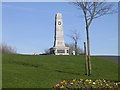
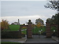
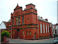
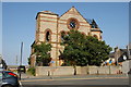
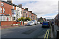
62 photos from this area
Area Information
Key information about the LA14 1QT including its size, population, and administrative classification.
- Area Type
- Postcode
- Area Size
- 7071 m²
- Population
- 1308
- Population Density
- 184977 people/km²
House Prices in LA14 1QT
29
Properties
£65,028
Average Sold Price
£19,000
Lowest Price
£125,000
Highest Price
Showing 29 properties
| Address | Type | Beds | Baths | Last Sale Price | Last Sale Date | |
|---|---|---|---|---|---|---|
| 40 Carlisle Street, Barrow In Furness, LA14 1QT | house | - | - | £125,000 | Jun 2024 | |
| 29 Carlisle Street, Barrow In Furness, LA14 1QT | Terraced | 3 | 1 | £76,000 | Feb 2023 | |
| 39 Carlisle Street, Barrow In Furness, LA14 1QT | house | - | - | £50,000 | May 2022 | |
| 41 Carlisle Street, Barrow In Furness, LA14 1QT | house | - | - | £97,500 | May 2022 | |
| 35 Carlisle Street, Barrow In Furness, LA14 1QT | house | - | - | £56,000 | Mar 2021 | |
| 43 Carlisle Street, Barrow In Furness, LA14 1QT | Terraced | 3 | 1 | £50,000 | Feb 2021 | |
| 25 Carlisle Street, Barrow In Furness, LA14 1QT | house | - | - | £71,500 | Nov 2019 | |
| 1 Carlisle Street, Barrow In Furness, LA14 1QT | Terraced | 4 | - | £66,000 | Jan 2018 | |
| 33 Carlisle Street, Barrow In Furness, LA14 1QT | Terraced | 4 | 3 | £45,000 | May 2017 | |
| 11 Carlisle Street, Barrow In Furness, LA14 1QT | house | 2 | - | £75,000 | Oct 2015 |
Page 1 of 3
Energy Efficiency in LA14 1QT
Amenities
Schools
| Rank | School | Type | Entry gender | Ages |
|---|
Explore more schools in this area
Go to Schools tabDemographics
Household Size
One person
most common
Accommodation Type
Houses
most common
Tenure
47
majority
Ethnic Group
White
most common
Religion
N/A
most common
Household Composition
N/A
most common
Age
47
median
Adults (30-64 years)
most common
Household Deprivation
N/A
with no deprivation
NS-SEC
17
in Lower managerial occupations
Explore more demographic insights in this area
Go to Demographics tabPlanning
Planning Constraints
- Flood RiskPremium
- Ramsar Wetland SitesPremium
- Area of Outstanding Natural BeautyPremium
- Protected Nature ReservePremium
- Protected WoodlandPremium