Area Overview for LA13 0RW
Photos of LA13 0RW
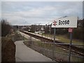
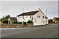
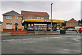
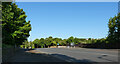
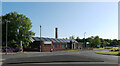
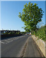
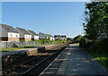
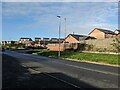
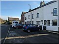
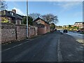
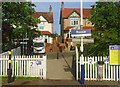
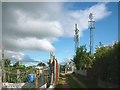
23 photos from this area
Area Information
Key information about the LA13 0RW including its size, population, and administrative classification.
- Area Type
- Postcode
- Area Size
- 1.4 hectares
- Population
- 1807
- Population Density
- 4271 people/km²
House Prices in LA13 0RW
28
Properties
£120,839
Average Sold Price
£34,750
Lowest Price
£231,000
Highest Price
Showing 28 properties
| Address | Type | Beds | Baths | Last Sale Price | Last Sale Date | |
|---|---|---|---|---|---|---|
| 1 Spruce Rise, Barrow In Furness, LA13 0RW | Semi-detached | 2 | 1 | £180,000 | Nov 2023 | |
| 26 Spruce Rise, Barrow In Furness, LA13 0RW | Semi-detached | 3 | 2 | £231,000 | Sep 2023 | |
| 38 Spruce Rise, Barrow In Furness, LA13 0RW | Semi-detached | 3 | 1 | £225,000 | Oct 2019 | |
| 11 Spruce Rise, Barrow In Furness, LA13 0RW | Semi-detached | 2 | 1 | £145,000 | Dec 2017 | |
| 5 Spruce Rise, Barrow In Furness, LA13 0RW | Bungalow | - | - | £135,000 | Oct 2016 | |
| 22 Spruce Rise, Barrow In Furness, LA13 0RW | house | 2 | - | £145,000 | May 2016 | |
| 32 Spruce Rise, Barrow In Furness, LA13 0RW | house | - | - | £175,000 | Jan 2012 | |
| 28 Spruce Rise, Barrow In Furness, LA13 0RW | Semi-detached | 3 | 1 | £170,000 | Aug 2011 | |
| 9 Spruce Rise, Barrow In Furness, LA13 0RW | Semi-detached | 2 | - | £118,000 | Jun 2011 | |
| 20 Spruce Rise, Barrow In Furness, LA13 0RW | Semi-detached | - | - | £180,500 | Jul 2005 |
Page 1 of 3
Energy Efficiency in LA13 0RW
Amenities
Schools
| Rank | School | Type | Entry gender | Ages |
|---|
Explore more schools in this area
Go to Schools tabDemographics
Household Size
Two person
most common
Accommodation Type
Houses
most common
Tenure
94
majority
Ethnic Group
White
most common
Religion
N/A
most common
Household Composition
N/A
most common
Age
47
median
Adults (30-64 years)
most common
Household Deprivation
N/A
with no deprivation
NS-SEC
42
in Lower managerial occupations
Explore more demographic insights in this area
Go to Demographics tabPlanning
Planning Constraints
- Flood RiskPremium
- Ramsar Wetland SitesPremium
- Area of Outstanding Natural BeautyPremium
- Protected Nature ReservePremium
- Protected WoodlandPremium