Area Overview for LA12 9FA
Photos of LA12 9FA
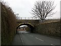
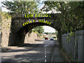
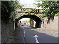
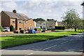
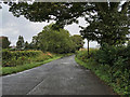
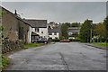
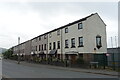
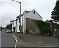
26 photos from this area
Area Information
Key information about the LA12 9FA including its size, population, and administrative classification.
- Area Type
- Postcode
- Area Size
- 4.7 hectares
- Population
- 1937
- Population Density
- 944 people/km²
House Prices in LA12 9FA
55
Properties
£342,535
Average Sold Price
£120,950
Lowest Price
£554,950
Highest Price
Showing 55 properties
| Address | Type | Beds | Baths | Last Sale Price | Last Sale Date | |
|---|---|---|---|---|---|---|
| 9 Charters Way, Ulverston, LA12 9FA | Detached | 4 | 3 | £490,000 | Aug 2024 | |
| 5 Charters Way, Ulverston, LA12 9FA | Semi-detached | 3 | 2 | £308,000 | Aug 2024 | |
| 79 Charters Way, Ulverston, LA12 9FA | Terraced | 2 | 1 | £143,500 | Mar 2024 | |
| 75 Charters Way, Ulverston, LA12 9FA | house | 2 | 1 | £143,500 | Mar 2024 | |
| 81 Charters Way, Ulverston, LA12 9FA | house | 2 | 1 | £143,500 | Mar 2024 | |
| 77 Charters Way, Ulverston, LA12 9FA | Terraced | 2 | 1 | £143,500 | Mar 2024 | |
| 8 Charters Way, Ulverston, LA12 9FA | house | 4 | 3 | £464,995 | Feb 2024 | |
| 73 Charters Way, Ulverston, LA12 9FA | house | - | - | £429,950 | Feb 2024 | |
| 71 Charters Way, Ulverston, LA12 9FA | house | - | - | £532,950 | Feb 2024 | |
| 69 Charters Way, Ulverston, LA12 9FA | house | - | - | £536,995 | Jan 2024 |
Page 1 of 6
Energy Efficiency in LA12 9FA
Amenities
Schools
| Rank | School | Type | Entry gender | Ages |
|---|
Explore more schools in this area
Go to Schools tabDemographics
Household Size
Two person
most common
Accommodation Type
Houses
most common
Tenure
68
majority
Ethnic Group
White
most common
Religion
N/A
most common
Household Composition
N/A
most common
Age
47
median
Adults (30-64 years)
most common
Household Deprivation
N/A
with no deprivation
NS-SEC
32
in Lower managerial occupations
Explore more demographic insights in this area
Go to Demographics tabPlanning
Planning Constraints
- Flood RiskPremium
- Ramsar Wetland SitesPremium
- Area of Outstanding Natural BeautyPremium
- Protected Nature ReservePremium
- Protected WoodlandPremium