Area Overview for LA12 9EN
Photos of LA12 9EN
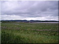
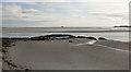
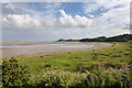
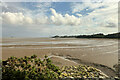
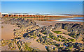
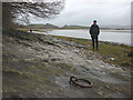
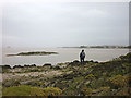
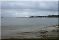
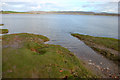
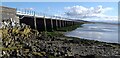
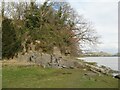
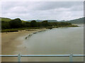
21 photos from this area
Area Information
Key information about the LA12 9EN including its size, population, and administrative classification.
- Area Type
- Postcode
- Area Size
- 63.9 hectares
- Population
- 1891
- Population Density
- 59 people/km²
House Prices in LA12 9EN
13
Properties
£263,800
Average Sold Price
£500
Lowest Price
£440,000
Highest Price
Showing 13 properties
| Address | Type | Beds | Baths | Last Sale Price | Last Sale Date | |
|---|---|---|---|---|---|---|
| Whispers, Canal Foot, Ulverston, LA12 9EN | Bungalow | 2 | 2 | £288,500 | Mar 2021 | |
| Sea Wood, Canal Foot, Ulverston, LA12 9EN | Bungalow | 4 | 3 | £440,000 | Jan 2021 | |
| The Moorings, Canal Foot, Ulverston, LA12 9EN | house | - | - | £275,000 | Jan 2020 | |
| Otter Bank, Canal Foot, Ulverston, LA12 9EN | Detached | - | - | £500 | Jul 2018 | |
| White Cragg, Canal Foot, Ulverston, LA12 9EN | Detached | - | - | £315,000 | Nov 2006 | |
| Brigadoon, Canal Foot, Ulverston, LA12 9EN | Detached | 3 | 2 | - | - | |
| Sea Cottage, Canal Foot, Ulverston, LA12 9EN | Bungalow | 2 | 1 | - | - | |
| Shore Croft, Canal Foot, Ulverston, LA12 9EN | Detached | 6 | 3 | - | - | |
| Mont Claire, Canal Foot, Ulverston, LA12 9EN | Detached | - | - | - | - | |
| Rose Cottage, Canal Foot, Ulverston, LA12 9EN | Detached | - | - | - | - |
Page 1 of 2
Energy Efficiency in LA12 9EN
Amenities
Schools
| Rank | School | Type | Entry gender | Ages |
|---|
Explore more schools in this area
Go to Schools tabDemographics
Household Size
Two person
most common
Accommodation Type
Houses
most common
Tenure
81
majority
Ethnic Group
White
most common
Religion
N/A
most common
Household Composition
N/A
most common
Age
47
median
Adults (30-64 years)
most common
Household Deprivation
N/A
with no deprivation
NS-SEC
40
in Lower managerial occupations
Explore more demographic insights in this area
Go to Demographics tabPlanning
Planning Constraints
- Flood RiskPremium
- Ramsar Wetland SitesPremium
- Area of Outstanding Natural BeautyPremium
- Protected Nature ReservePremium
- Protected WoodlandPremium