Area Overview for LA12 8DW
Photos of LA12 8DW
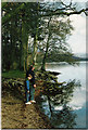
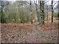
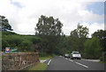
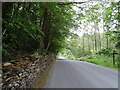
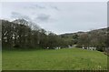
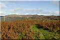
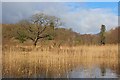
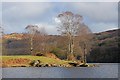
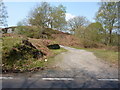
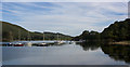
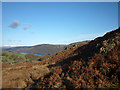
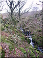
20 photos from this area
Area Information
Key information about the LA12 8DW including its size, population, and administrative classification.
- Area Type
- Postcode
- Area Size
- 19.1 hectares
- Population
- 1546
- Population Density
- 14 people/km²
House Prices in LA12 8DW
11
Properties
£511,625
Average Sold Price
£160,000
Lowest Price
£863,250
Highest Price
Showing 11 properties
| Address | Type | Beds | Baths | Last Sale Price | Last Sale Date | |
|---|---|---|---|---|---|---|
| Old Brown Howe Barn, Water Yeat, Water Yeat, Ulverston, LA12 8DW | house | 4 | 2 | £863,250 | Nov 2017 | |
| Brown Howe Cottage, Water Yeat, Water Yeat, Ulverston, LA12 8DW | Detached | - | - | £160,000 | Dec 1999 | |
| Potters Wheel, Water Yeat, Water Yeat, Ulverston, LA12 8DW | Detached | - | - | - | - | |
| The Farmhouse, Old Brown Howe, Water Yeat, Water Yeat, Ulverston, LA12 8DW | Detached | - | - | - | - | |
| Thurston Mere, Brown Howe, Water Yeat, Water Yeat, Ulverston, LA12 8DW | Flat | - | - | - | - | |
| Tanglewood, Brown Howe, Water Yeat, Water Yeat, Ulverston, LA12 8DW | house | - | - | - | - | |
| Flat 2, Brown Howe, Water Yeat, Water Yeat, Ulverston, LA12 8DW | Flat | - | - | - | - | |
| Horseshoes, Brown Howe, Water Yeat, Water Yeat, Ulverston, LA12 8DW | Flat | - | - | - | - | |
| Flat 3, Brown Howe, Water Yeat, Water Yeat, Ulverston, LA12 8DW | Flat | - | - | - | - | |
| Copper Beech Lodge, Water Yeat, Water Yeat, Ulverston, LA12 8DW | house | - | - | - | - |
Page 1 of 2
Energy Efficiency in LA12 8DW
Amenities
Schools
| Rank | School | Type | Entry gender | Ages |
|---|
Explore more schools in this area
Go to Schools tabDemographics
Household Size
Two person
most common
Accommodation Type
Houses
most common
Tenure
66
majority
Ethnic Group
White
most common
Religion
N/A
most common
Household Composition
N/A
most common
Age
47
median
Adults (30-64 years)
most common
Household Deprivation
N/A
with no deprivation
NS-SEC
35
in Lower managerial occupations
Explore more demographic insights in this area
Go to Demographics tabPlanning
Planning Constraints
- Flood RiskPremium
- Ramsar Wetland SitesPremium
- Area of Outstanding Natural BeautyPremium
- Protected Nature ReservePremium
- Protected WoodlandPremium