Area Overview for LA12 7BT
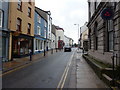
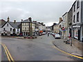
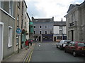
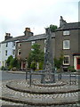
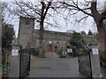
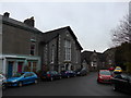
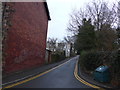
Photos of LA12 7BT

Area Information
Living in LA12 7BT offers a compact, residential experience shaped by its small cluster of homes and proximity to key services. With a population of 1,984 and a density of 1,043 people per square kilometre, the area is tight-knit yet functional. The median age of 47 suggests a mature community, with most residents falling within the 30–64 age range. This reflects a stable, family-oriented demographic, where homeownership is prevalent at 74%. The area’s housing stock is predominantly houses, not flats, which aligns with its character as a low-density, residential postcode. Daily life is anchored by nearby amenities, including a primary school with a good Ofsted rating and multiple retail and transport options. While the postcode is small, its accessibility to Ulverston’s infrastructure, including rail links and supermarkets, ensures practicality for residents. The absence of major environmental constraints, such as protected woodlands or AONB designations, means development pressures are minimal. For buyers, LA12 7BT presents a blend of quiet living and connectivity, ideal for those seeking a settled, community-focused environment without sacrificing access to essentials.
- Area Type
- Postcode
- Area Size
- Not available
- Population
- 1984
- Population Density
- 1043 people/km²
The property market in LA12 7BT is defined by high home ownership (74%) and a predominance of houses over flats. This suggests a market skewed towards owner-occupation, with limited rental availability. The focus on houses implies larger properties, likely suited to families or those seeking more space. Given the area’s small size, the housing stock is finite, meaning buyers may face competition for available properties. The lack of flats or apartments indicates a lack of high-density development, which could appeal to those prioritising privacy and space over urban convenience. For buyers, this means a market where properties are likely to be long-term investments rather than short-term rentals. The absence of planning constraints, such as protected woodlands or AONB designations, may also make the area more attractive for those seeking flexibility in property use. However, the limited scale of the area means the market is niche, with little scope for expansion or new builds.
House Prices in LA12 7BT
Showing 2 properties
| Address | Type | Beds | Baths | Last Sale Price | Last Sale Date | |
|---|---|---|---|---|---|---|
| Ulverston Community Health Centre, Stanley Street, Ulverston, LA12 7BT | hospital_care_home | - | - | - | - | |
| Ulverston Hospital, Stanley Street, Ulverston, LA12 7BT | hospital_care_home | - | - | - | - |
Energy Efficiency in LA12 7BT
Residents of LA12 7BT have access to a range of amenities within practical reach, including retail, transport, and community hubs. The area’s retail options include major supermarkets like Tesco Ulverston, Morrisons Daily, and Co-op Market, ensuring everyday shopping needs are met without long commutes. The presence of multiple rail stations—Ulverston, Kirkby, and Askam—alongside the Haverthwaite metro stop, provides reliable transport links for commuting or leisure travel. While the area lacks large parks or leisure facilities, its proximity to Ulverston’s broader offerings likely compensates. The compact nature of LA12 7BT means amenities are concentrated, fostering a convenient, walkable lifestyle. This balance of retail, transport, and connectivity supports a practical daily routine, with minimal need for extended travel. The area’s small size and accessibility make it suitable for those prioritising convenience over expansive recreational spaces.
Amenities
Schools
The nearest school to LA12 7BT is Church Walk CofE Primary School, which serves the area’s primary education needs. Rated ‘good’ by Ofsted, it provides a reliable foundation for local children. The absence of secondary schools in the immediate vicinity means families may need to look further afield for secondary education, though Ulverston’s broader infrastructure likely offers options. The presence of a single primary school suggests a focus on early education within the community, which can foster a sense of cohesion among local families. For parents, the school’s rating indicates a standard of teaching and resources that meets expectations, though the lack of additional educational facilities may require planning for commuting to secondary schools. The school’s role as a central institution reinforces the area’s identity as a family-oriented postcode, where education is a key consideration for residents.
| Rank | School | Type | Entry gender | Ages |
|---|
Explore more schools in this area
Go to Schools tabDemographics
The community in LA12 7BT is predominantly composed of adults aged 30–64, with a median age of 47. This suggests a mature, established population, likely with long-term ties to the area. Homeownership is high at 74%, indicating stability and a focus on long-term residency rather than transient rental markets. The accommodation type is largely houses, not flats, which aligns with the area’s low-density profile. The predominant ethnic group is White, with no data provided on other demographics. The absence of specific information on deprivation or diversity metrics means the area’s social composition remains largely uncharacterised beyond these figures. For quality of life, the high home ownership rate and age profile suggest a community with strong family ties and lower turnover. However, without further data on income levels or social diversity, it is difficult to assess broader socioeconomic factors. The area’s demographic profile positions it as a place for settled, middle-aged residents prioritising stability over rapid change.
Household Size
Accommodation Type
Tenure
Ethnic Group
Religion
Household Composition
Age
Household Deprivation
NS-SEC
Explore more demographic insights in this area
Go to Demographics tabPlanning
Planning Constraints
- Flood RiskPremium
- Ramsar Wetland SitesPremium
- Area of Outstanding Natural BeautyPremium
- Protected Nature ReservePremium
- Protected WoodlandPremium