Area Overview for LA12 0DF
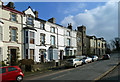
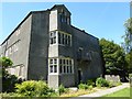
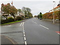
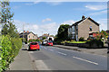
Photos of LA12 0DF


Area Information
Living in LA12 0DF means inhabiting a small, tightly knit residential cluster in England, where 1,937 people reside across a compact area. The population density of 944 people per square kilometre reflects a modest, community-oriented environment. This postcode is characterised by its proximity to essential services and a mix of local amenities that cater to daily needs. The area’s compact size fosters a sense of familiarity, with residents likely to know their neighbours. Nearby, Croftlands Infant and Junior Schools provide education for younger families, while Ulverston Railway Station and Dalton Railway Station offer reliable connections to broader networks. Retail options such as Tesco Ulverston and Co-op Market ensure convenience for shopping. LA12 0DF is not a sprawling suburb but a focused, functional space where practicality and accessibility define the rhythm of daily life. Its small scale means that the area is likely to feel cohesive, with a strong emphasis on local infrastructure and community hubs.
- Area Type
- Postcode
- Area Size
- Not available
- Population
- 1937
- Population Density
- 944 people/km²
The property market in LA12 0DF is defined by a strong emphasis on owner-occupation, with 68% of homes owned by their residents. This suggests a stable, long-term demographic that prioritises homeownership over rental properties. The accommodation type is predominantly houses, which may appeal to families seeking space and privacy. Given the area’s small size, the housing stock is likely limited, with few new developments. Buyers considering LA12 0DF should be aware that the immediate surroundings may offer more options, but the area itself is compact and focused. The high home ownership rate indicates a low turnover of properties, which could mean a slower-moving market. For those seeking a home in this postcode, the emphasis on houses may align with preferences for traditional, family-friendly housing. However, the limited size of the area means that buyers may need to look beyond the immediate postcode for a broader selection.
House Prices in LA12 0DF
No properties found in this postcode.
Energy Efficiency in LA12 0DF
The lifestyle in LA12 0DF is shaped by its proximity to essential amenities and services. Retail options such as Tesco Ulverston, Co-op Market, and Morrisons Daily provide a range of shopping and food choices, reducing the need for long trips. The area’s railway stations, including Ulverston and Dalton, offer access to broader transport networks, enabling easy travel to nearby towns. While specific parks or leisure facilities are not detailed in the data, the presence of multiple retail and transport hubs suggests a focus on practicality over expansive recreational spaces. The compact nature of the area may mean that residents rely on nearby towns for larger amenities, but the immediate vicinity offers enough to support daily life. The combination of local shops, transport links, and schools creates a functional environment where convenience and accessibility are prioritised.
Amenities
Schools
Residents of LA12 0DF benefit from a cluster of well-regarded primary schools. Croftlands Infant School and Croftlands Junior School provide early and primary education, both with Ofsted ratings of ‘good’. These schools are likely to serve the local community, offering a consistent educational pathway for children. The presence of two schools in the same area may reduce the need for long commutes, making it convenient for families. Ulverston Victoria High School is also listed in the data, though its category as a primary school may be an error. Assuming it is a secondary school, its inclusion would further strengthen the educational options available. The mix of primary schools with strong ratings suggests that the area is attractive to families seeking reliable, locally based education. This could be a significant factor for homebuyers prioritising schools in their decision-making process.
| Rank | School | Type | Entry gender | Ages |
|---|
Explore more schools in this area
Go to Schools tabDemographics
The demographic profile of LA12 0DF is shaped by a median age of 47, with the majority of residents falling within the 30–64 age range. This suggests a mature, established community with a focus on stability and long-term residence. Home ownership is high, with 68% of households owning their properties, indicating a preference for settled living over rental tenancies. The accommodation type is predominantly houses, which aligns with the area’s residential character. The predominant ethnic group is White, reflecting a homogenous demographic profile. The absence of specific data on diversity or deprivation means that the community’s social fabric is not explicitly detailed, but the high home ownership rate and age distribution suggest a population that values security and continuity. The compact size of the area may contribute to a tightly knit social environment, where residents share common needs and local amenities.
Household Size
Accommodation Type
Tenure
Ethnic Group
Religion
Household Composition
Age
Household Deprivation
NS-SEC
Explore more demographic insights in this area
Go to Demographics tabPlanning
Planning Constraints
- Flood RiskPremium
- Ramsar Wetland SitesPremium
- Area of Outstanding Natural BeautyPremium
- Protected Nature ReservePremium
- Protected WoodlandPremium