Area Overview for LA11 7QA
Photos of LA11 7QA
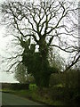
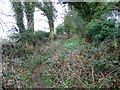
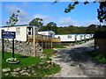
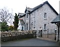
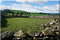
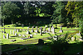
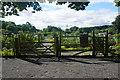
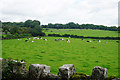

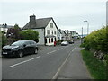
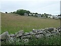
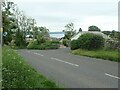
31 photos from this area
Area Information
Key information about the LA11 7QA including its size, population, and administrative classification.
- Area Type
- Postcode
- Area Size
- 55.3 hectares
- Population
- 1329
- Population Density
- 222 people/km²
House Prices in LA11 7QA
21
Properties
£270,000
Average Sold Price
£185,000
Lowest Price
£400,000
Highest Price
Showing 21 properties
| Address | Type | Beds | Baths | Last Sale Price | Last Sale Date | |
|---|---|---|---|---|---|---|
| Underwood, Cartmel Road, Grange Over Sands, LA11 7QA | house | - | - | £225,000 | Jun 2008 | |
| Linksfield, Cartmel Road, Grange Over Sands, LA11 7QA | Detached | - | - | £400,000 | Jul 2006 | |
| Middle Fellgate Farm, Cartmel Road, Grange Over Sands, LA11 7QA | house | - | - | £185,000 | May 2001 | |
| 4, High Fell Gate Barns, Cartmel Road, Grange Over Sands, LA11 7QA | Semi-detached | 3 | 2 | - | - | |
| 3, High Fell Gate Barns, Cartmel Road, Grange Over Sands, LA11 7QA | Semi-detached | 2 | 1 | - | - | |
| 19, Lingwood Park, Cartmel Road, Grange Over Sands, LA11 7QA | Mobile Home | 3 | - | - | - | |
| 1, High Fell Gate Barns, Cartmel Road, Grange Over Sands, LA11 7QA | Semi-detached | 4 | 2 | - | - | |
| Clearwater Chalet, Lingwood Park, Cartmel Road, Grange Over Sands, LA11 7QA | Mobile Home | - | - | - | - | |
| 6, Lingwood Park, Cartmel Road, Grange Over Sands, LA11 7QA | Mobile Home | - | - | - | - | |
| Caravan Site, High Fellgate Farm, Cartmel Road, Grange Over Sands, LA11 7QA | Leisure | - | - | - | - |
Page 1 of 3
Energy Efficiency in LA11 7QA
Amenities
Schools
| Rank | School | Type | Entry gender | Ages |
|---|
Explore more schools in this area
Go to Schools tabDemographics
Household Size
One person
most common
Accommodation Type
Houses
most common
Tenure
69
majority
Ethnic Group
White
most common
Religion
N/A
most common
Household Composition
N/A
most common
Age
47
median
Elderly (65+ years)
most common
Household Deprivation
N/A
with no deprivation
NS-SEC
36
in Lower managerial occupations
Explore more demographic insights in this area
Go to Demographics tabPlanning
Planning Constraints
- Flood RiskPremium
- Ramsar Wetland SitesPremium
- Area of Outstanding Natural BeautyPremium
- Protected Nature ReservePremium
- Protected WoodlandPremium