Area Overview for LA11 6EJ
Photos of LA11 6EJ


Area Information
Living in LA11 6EJ offers a quiet, small-scale residential experience in a compact area of 7,552 square metres. With a population of 1,329 people spread across 222 residents per square kilometre, this postcode area feels intentionally low-density, blending rural tranquillity with practical accessibility. The community is characterised by its older demographic, with a median age of 47 and a significant proportion of residents aged 65 and over. This suggests a mature, settled population, likely drawn to the area’s low crime rates and proximity to natural landscapes. Daily life here is shaped by the surrounding amenities, including nearby rail stations, retail outlets, and ferry access to lakes. While the area lacks large-scale infrastructure, its compact size ensures that essential services remain within walking or short driving distance. For those seeking a peaceful, low-maintenance lifestyle, LA11 6EJ provides a stable environment with minimal urban pressures, though its small size means limited options for expansion or development.
- Area Type
- Postcode
- Area Size
- 7552 m²
- Population
- 1329
- Population Density
- 222 people/km²
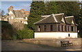
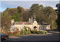
The property market in LA11 6EJ is defined by its high home ownership rate of 69% and a focus on houses rather than flats or apartments. This suggests a market dominated by owner-occupied properties, likely attracting buyers seeking long-term stability rather than investment. The prevalence of houses aligns with the area’s low-density layout, offering larger, more private living spaces. However, the small size of the postcode—just 7,552 square metres—means the housing stock is limited, and buyers may need to consider nearby areas for more options. The lack of rental properties indicates a community where homeownership is the norm, which could be appealing to those prioritising security and permanence. For prospective buyers, this market presents a mix of established homes in a quiet setting, though the limited scale of the area may restrict availability for those seeking new builds or larger properties.
House Prices in LA11 6EJ
Showing 1 properties
| Address | Type | Beds | Baths | Last Sale Price | Last Sale Date | |
|---|---|---|---|---|---|---|
| Grange Hotel, Station Square, Grange Over Sands, LA11 6EJ | hotel | - | - | - | - |
Energy Efficiency in LA11 6EJ
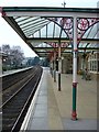
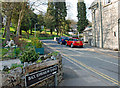
Life in LA11 6EJ is shaped by its proximity to natural and practical amenities. Retail options include Spar, Co-op Grange, and Tesco Grange, ensuring everyday shopping needs are met. The area’s rail and metro stations—Grange, Haverthwaite, and Newby Bridge—connect residents to broader regional networks, while ferry landings at Fell Foot Country Park and Lakeside Windermere provide access to lakeside recreation. The presence of multiple transport hubs suggests a community that values mobility, whether for commuting or leisure. The compact layout means amenities are clustered closely, reducing the need for long journeys. This blend of retail, transport, and natural access creates a lifestyle that balances convenience with the quiet charm of a smaller postcode, ideal for those who prioritise ease of access over urban density.
Amenities
Schools
The nearest school to LA11 6EJ is Fell House School, a special school with an Ofsted rating of ‘good’. This institution serves students with specific educational needs, making it a critical resource for families in the area. The absence of other schools in the immediate vicinity means that families relying on mainstream primary or secondary education may need to look further afield. However, the presence of a well-rated special school suggests that the area caters to a particular demographic, possibly those with children requiring tailored support. For parents prioritising accessibility, the proximity of Fell House School is a significant advantage, though it underscores the limited range of educational options within the postcode itself.
| Rank | School | Type | Entry gender | Ages |
|---|
Explore more schools in this area
Go to Schools tabDemographics
The population of LA11 6EJ is predominantly elderly, with 65+ years being the most common age range. This aligns with a median age of 47, indicating a community skewed towards older residents. Home ownership is high at 69%, suggesting a stable, long-term resident base rather than a transient rental market. The accommodation type is primarily houses, which is unusual in areas with higher population densities but fits with the low-density, rural character of the postcode. The predominant ethnic group is White, though no further breakdown of diversity is provided. The absence of specific data on deprivation or income levels means the area’s quality of life can only be inferred from the low crime score and limited environmental constraints. This demographic profile implies a community focused on comfort and familiarity, with fewer young families or commuters compared to larger urban areas.
Household Size
Accommodation Type
Tenure
Ethnic Group
Religion
Household Composition
Age
Household Deprivation
NS-SEC
Explore more demographic insights in this area
Go to Demographics tabPlanning
Planning Constraints
- Flood RiskPremium
- Ramsar Wetland SitesPremium
- Area of Outstanding Natural BeautyPremium
- Protected Nature ReservePremium
- Protected WoodlandPremium