Area Overview for LA1 5XG
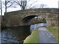
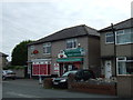
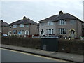
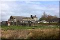
Photos of LA1 5XG


Area Information
Living in LA1 5XG offers a compact, residential experience with a population of 2182, reflecting a tight-knit community. This small postcode area is characterised by its cluster of homes, predominantly owner-occupied, catering to a demographic skewed towards adults aged 30–64. The area’s proximity to key services and transport links makes it practical for daily life. Residents benefit from strong digital connectivity, with broadband scores nearing 100, ensuring seamless online access for work or leisure. While crime rates are average, safety measures remain standard. The presence of two primary schools, including Skerton St Luke’s Church of England Primary School with a good Ofsted rating, adds to the appeal for families. LA1 5XG balances suburban tranquillity with access to nearby amenities, making it a viable choice for those seeking stability and convenience in a well-connected, low-risk environment.
- Area Type
- Postcode
- Area Size
- Not available
- Population
- 2182
- Population Density
- 5657 people/km²
LA1 5XG is primarily an owner-occupied area, with 64% of homes owned by residents rather than rented. The accommodation type is predominantly houses, which suggests a focus on family-friendly or semi-detached housing. This contrasts with areas dominated by flats or rental properties, offering a different dynamic for buyers. The small size of the postcode means the housing stock is limited, potentially making the market competitive for those seeking properties in this specific area. However, proximity to nearby towns like Lancaster and Morecambe may provide additional options for buyers considering the broader region. The prevalence of houses indicates a demand for space and privacy, which could appeal to families or professionals prioritising comfort over urban density.
House Prices in LA1 5XG
No properties found in this postcode.
Energy Efficiency in LA1 5XG
The lifestyle in LA1 5XG is supported by nearby amenities that cater to everyday needs. Retail options include Morrisons Daily, Asda Rylands, and Spar, ensuring accessible shopping for groceries and essentials. The area’s rail links to Lancaster, Bare Lane, and Morecambe provide easy access to urban centres, while the Heysham Ferry Terminal connects to broader regional travel. Although no parks or leisure facilities are explicitly listed, the absence of environmental constraints like AONB or protected areas suggests space for local recreation. The presence of multiple retail and transport hubs indicates a practical, convenience-driven lifestyle, ideal for those prioritising accessibility over sprawling natural landscapes.
Amenities
Schools
Residents of LA1 5XG have access to two primary schools within practical reach. Skerton St Luke’s Church of England Primary School is noted for its good Ofsted rating, offering a reliable educational option for families. St Joseph’s Catholic Primary School in Lancaster provides an alternative, though its rating is not specified. The presence of both church-affiliated and Catholic schools reflects a diverse range of educational choices, accommodating different family preferences. For parents, this mix ensures options aligned with religious or philosophical values. The proximity of these schools to the area underscores its appeal for families seeking established, locally rooted education systems. With no secondary schools listed, residents may need to consider commuting to nearby towns for higher education.
| Rank | School | Type | Entry gender | Ages |
|---|
Explore more schools in this area
Go to Schools tabDemographics
The population of LA1 5XG is 2182, with a median age of 47, indicating a mature demographic. The most common age group is adults aged 30–64, suggesting a community of established professionals and families. Home ownership stands at 64%, reflecting a strong presence of owner-occupied properties. The area is dominated by houses rather than flats, aligning with a preference for larger, private living spaces. The predominant ethnic group is White, though no specific diversity statistics are provided. This age profile and ownership rate imply a stable, long-term resident base. The absence of detailed deprivation data means quality of life can be inferred from the area’s amenities and safety profile. With no significant environmental constraints, the community appears focused on practical living over niche specialisation.
Household Size
Accommodation Type
Tenure
Ethnic Group
Religion
Household Composition
Age
Household Deprivation
NS-SEC
Explore more demographic insights in this area
Go to Demographics tabPlanning
Planning Constraints
- Flood RiskPremium
- Ramsar Wetland SitesPremium
- Area of Outstanding Natural BeautyPremium
- Protected Nature ReservePremium
- Protected WoodlandPremium