Area Overview for LA1 4JE
Photos of LA1 4JE
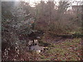
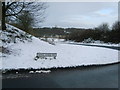

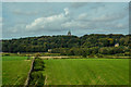
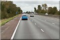
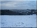
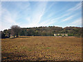
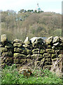
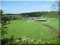
26 photos from this area
Area Information
Key information about the LA1 4JE including its size, population, and administrative classification.
- Area Type
- Postcode
- Area Size
- 8.8 hectares
- Population
- 1377
- Population Density
- 3438 people/km²
House Prices in LA1 4JE
22
Properties
£200,679
Average Sold Price
£89,500
Lowest Price
£375,000
Highest Price
Showing 22 properties
| Address | Type | Beds | Baths | Last Sale Price | Last Sale Date | |
|---|---|---|---|---|---|---|
| 120 Newlands Road, Lancaster, LA1 4JE | Detached | 4 | 2 | £250,000 | Mar 2024 | |
| 114 Newlands Road, Lancaster, LA1 4JE | Detached | 4 | 4 | £375,000 | Nov 2023 | |
| 33 Newlands Road, Lancaster, LA1 4JE | house | - | - | £255,000 | Feb 2021 | |
| 112 Newlands Road, Lancaster, LA1 4JE | Bungalow | - | - | £250,000 | Nov 2015 | |
| 39 Newlands Road, Lancaster, LA1 4JE | house | - | - | £249,999 | Feb 2012 | |
| 100 Newlands Road, Lancaster, LA1 4JE | Detached | - | - | £205,000 | Dec 2007 | |
| 106 Newlands Road, Lancaster, LA1 4JE | Detached | - | - | £244,000 | Jun 2007 | |
| 31 Newlands Road, Lancaster, LA1 4JE | Semi-detached | - | - | £143,000 | Jul 2005 | |
| 90 Newlands Road, Lancaster, LA1 4JE | Detached | - | - | £285,000 | Aug 2004 | |
| 96 Newlands Road, Lancaster, LA1 4JE | house | - | - | £182,500 | Apr 2003 |
Page 1 of 3
Energy Efficiency in LA1 4JE
Amenities
Schools
| Rank | School | Type | Entry gender | Ages |
|---|
Explore more schools in this area
Go to Schools tabDemographics
Household Size
Two person
most common
Accommodation Type
Houses
most common
Tenure
91
majority
Ethnic Group
White
most common
Religion
N/A
most common
Household Composition
N/A
most common
Age
47
median
Adults (30-64 years)
most common
Household Deprivation
N/A
with no deprivation
NS-SEC
40
in Lower managerial occupations
Explore more demographic insights in this area
Go to Demographics tabPlanning
Planning Constraints
- Flood RiskPremium
- Ramsar Wetland SitesPremium
- Area of Outstanding Natural BeautyPremium
- Protected Nature ReservePremium
- Protected WoodlandPremium