Area Overview for LA1 4AG
Photos of LA1 4AG

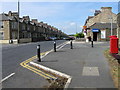
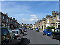
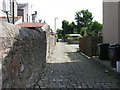
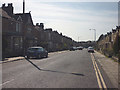
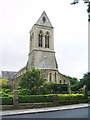
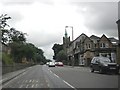
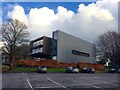
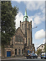
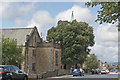
50 photos from this area
Area Information
Key information about the LA1 4AG including its size, population, and administrative classification.
- Area Type
- Postcode
- Area Size
- 1598 m²
- Population
- 2303
- Population Density
- 10163 people/km²
House Prices in LA1 4AG
9
Properties
£140,071
Average Sold Price
£50,000
Lowest Price
£175,000
Highest Price
Showing 9 properties
| Address | Type | Beds | Baths | Last Sale Price | Last Sale Date | |
|---|---|---|---|---|---|---|
| 61 Bowerham Road, Lancaster, LA1 4AG | house | - | - | £175,000 | Sep 2021 | |
| 53 Bowerham Road, Lancaster, LA1 4AG | Terraced | 3 | 1 | £169,000 | Dec 2019 | |
| 63 Bowerham Road, Lancaster, LA1 4AG | Terraced | 2 | 1 | £173,000 | Jun 2019 | |
| 59 Bowerham Road, Lancaster, LA1 4AG | Terraced | 6 | 6 | £163,500 | Nov 2018 | |
| 57 Bowerham Road, Lancaster, LA1 4AG | Terraced | 3 | 1 | £135,000 | Mar 2014 | |
| 55 Bowerham Road, Lancaster, LA1 4AG | house | - | - | £115,000 | Dec 2003 | |
| 65 Bowerham Road, Lancaster, LA1 4AG | house | - | - | £50,000 | May 2000 | |
| 67 Bowerham Road, Lancaster, LA1 4AG | Terraced | - | - | - | - | |
| 69A Bowerham Road, Lancaster, LA1 4AG | Maisonette | - | - | - | - |
Energy Efficiency in LA1 4AG
Amenities
Schools
| Rank | School | Type | Entry gender | Ages |
|---|
Explore more schools in this area
Go to Schools tabDemographics
Household Size
Family (3-5 people)
most common
Accommodation Type
Houses
most common
Tenure
41
majority
Ethnic Group
White
most common
Religion
N/A
most common
Household Composition
N/A
most common
Age
22
median
Young Adults (15-29 years)
most common
Household Deprivation
N/A
with no deprivation
NS-SEC
18
in Lower managerial occupations
Explore more demographic insights in this area
Go to Demographics tabPlanning
Planning Constraints
- Flood RiskPremium
- Ramsar Wetland SitesPremium
- Area of Outstanding Natural BeautyPremium
- Protected Nature ReservePremium
- Protected WoodlandPremium