Area Overview for L9 8BQ
Photos of L9 8BQ

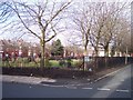
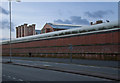
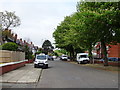
18 photos from this area
Area Information
Key information about the L9 8BQ including its size, population, and administrative classification.
- Area Type
- Postcode
- Area Size
- 1.2 hectares
- Population
- 2302
- Population Density
- 7472 people/km²
House Prices in L9 8BQ
39
Properties
£216,646
Average Sold Price
£80,000
Lowest Price
£340,000
Highest Price
Showing 39 properties
| Address | Type | Beds | Baths | Last Sale Price | Last Sale Date | |
|---|---|---|---|---|---|---|
| 34 Albert Drive, Bootle, L9 8BQ | house | 6 | 2 | £244,000 | Apr 2022 | |
| 14 Albert Drive, Liverpool, L9 8BQ | Semi-detached | 5 | 2 | £322,260 | Jun 2021 | |
| 4 Albert Drive, Liverpool, L9 8BQ | house | - | - | £340,000 | Sep 2020 | |
| 28 Albert Drive, Liverpool, L9 8BQ | Semi-detached | 7 | 2 | £273,500 | Jan 2020 | |
| 26 Albert Drive, Liverpool, L9 8BQ | Semi-detached | 5 | 2 | £200,000 | Oct 2018 | |
| 12 Albert Drive, Liverpool, L9 8BQ | house | - | - | £150,000 | Nov 2012 | |
| 22 Albert Drive, Liverpool, L9 8BQ | house | - | - | £249,995 | Apr 2009 | |
| 2 Albert Drive, Liverpool, L9 8BQ | Semi-detached | 4 | - | £130,000 | Mar 2009 | |
| 8 Albert Drive, Liverpool, L9 8BQ | Terraced | - | - | £230,000 | Mar 2007 | |
| 6 Albert Drive, Liverpool, L9 8BQ | Terraced | - | - | £275,000 | Jul 2006 |
Page 1 of 4
Energy Efficiency in L9 8BQ
Amenities
Schools
| Rank | School | Type | Entry gender | Ages |
|---|
Explore more schools in this area
Go to Schools tabDemographics
Household Size
Family (3-5 people)
most common
Accommodation Type
Houses
most common
Tenure
75
majority
Ethnic Group
White
most common
Religion
N/A
most common
Household Composition
N/A
most common
Age
47
median
Adults (30-64 years)
most common
Household Deprivation
N/A
with no deprivation
NS-SEC
21
in Lower managerial occupations
Explore more demographic insights in this area
Go to Demographics tabPlanning
Planning Constraints
- Flood RiskPremium
- Ramsar Wetland SitesPremium
- Area of Outstanding Natural BeautyPremium
- Protected Nature ReservePremium
- Protected WoodlandPremium