Area Overview for L9 7DU
Photos of L9 7DU


Area Information
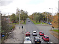
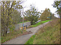
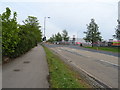
Living in L9 7DU offers a quiet, residential experience in a small cluster of homes with a population of 1,338. This postcode area is characterised by a mature demographic, with a median age of 47 and a strong presence of adults aged 30–64. The community is predominantly owner-occupied, with 61% of homes owned by residents, and the housing stock consists largely of traditional houses. Daily life here is shaped by proximity to essential services, including five retail outlets like Asda Walton and Sainsburys Rice, as well as rail links to Rice Lane and Walton stations. The area’s compact size fosters a sense of familiarity, though its small footprint means residents may need to venture slightly further for broader amenities. With no significant environmental constraints and low flood risk, L9 7DU presents a stable, low-maintenance living environment, ideal for those seeking a settled, community-focused lifestyle without the pressures of urban density.
- Area Type
- Postcode
- Area Size
- Not available
- Population
- 1338
- Population Density
- 2063 people/km²
The property market in L9 7DU is dominated by owner-occupied homes, with 61% of properties owned by residents. The accommodation type is primarily houses, which suggests a focus on single-family dwellings rather than flats or apartments. This configuration is typical of a small, residential postcode area where housing stock is limited in scale. The market is likely to be stable, with fewer rental properties, which may appeal to buyers seeking long-term investment or family homes. However, the small size of the area means that the immediate housing options are constrained, and buyers may need to consider nearby postcode areas for a broader selection. The presence of traditional houses also implies a more established character, which could be a draw for those prioritising heritage or spacious living over modern developments.
House Prices in L9 7DU
No properties found in this postcode.
Energy Efficiency in L9 7DU
Residents of L9 7DU have access to a range of amenities within practical reach, including five retail outlets such as Asda Walton, Sainsburys Rice, and Aldi Norris, ensuring everyday shopping needs are met locally. The area’s rail network, with stations like Rice Lane and Walton, provides convenient links to nearby towns and cities, while nearby ferry terminals offer direct routes to Belfast, the Isle of Man, and Dublin. Though the area itself is small, its proximity to these services means residents can enjoy both local convenience and broader connectivity. The presence of multiple retail and transport hubs suggests a practical, no-frills lifestyle, where daily errands and travel are efficiently managed without the need for long commutes. This balance of accessibility and compact living makes L9 7DU appealing to those who prioritise functionality over sprawling urban amenities.
Amenities
Schools
| Rank | School | Type | Entry gender | Ages |
|---|
Explore more schools in this area
Go to Schools tabDemographics
The population of L9 7DU is 1,338, with a median age of 47, indicating a mature, settled community. The most common age range is 30–64 years, suggesting a strong presence of middle-aged and older residents, many of whom may be in their prime working or retirement years. Home ownership stands at 61%, reflecting a stable housing market where most residents live in properties they own. The predominant accommodation type is houses, which aligns with the area’s character as a residential cluster rather than a high-density development. The predominant ethnic group is White, which is typical for this part of England. While no specific data on deprivation is provided, the high home ownership rate and low environmental risk assessments imply a relatively secure quality of life, with fewer socioeconomic pressures compared to more deprived areas.
Household Size
Accommodation Type
Tenure
Ethnic Group
Religion
Household Composition
Age
Household Deprivation
NS-SEC
Explore more demographic insights in this area
Go to Demographics tabPlanning
Planning Constraints
- Flood RiskPremium
- Ramsar Wetland SitesPremium
- Area of Outstanding Natural BeautyPremium
- Protected Nature ReservePremium
- Protected WoodlandPremium