Area Overview for L9 6GB
Photos of L9 6GB
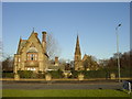
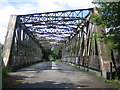
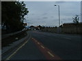
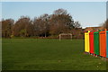
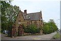
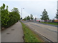
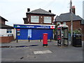
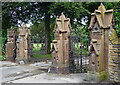
24 photos from this area
Area Information
Key information about the L9 6GB including its size, population, and administrative classification.
- Area Type
- Postcode
- Area Size
- 1.0 hectares
- Population
- 2152
- Population Density
- 5971 people/km²
House Prices in L9 6GB
32
Properties
£102,817
Average Sold Price
£48,000
Lowest Price
£156,000
Highest Price
Showing 32 properties
| Address | Type | Beds | Baths | Last Sale Price | Last Sale Date | |
|---|---|---|---|---|---|---|
| 20 Harbreck Grove, Liverpool, L9 6GB | Flat | - | - | £93,000 | Jul 2025 | |
| 28 Harbreck Grove, Liverpool, L9 6GB | Terraced | 3 | 3 | £145,000 | Oct 2023 | |
| 17 Harbreck Grove, Liverpool, L9 6GB | Flat | - | - | £75,000 | Sep 2023 | |
| 2 Harbreck Grove, Liverpool, L9 6GB | Semi-detached | 3 | 3 | £156,000 | Aug 2023 | |
| 29 Harbreck Grove, Liverpool, L9 6GB | Terraced | 3 | 2 | £125,000 | Apr 2021 | |
| 11 Harbreck Grove, Liverpool, L9 6GB | Flat | - | - | £70,000 | Jan 2020 | |
| 14 Harbreck Grove, Liverpool, L9 6GB | Flat | - | - | £58,500 | May 2018 | |
| 12 Harbreck Grove, Liverpool, L9 6GB | Flat | 2 | 1 | £58,500 | May 2018 | |
| 16 Harbreck Grove, Liverpool, L9 6GB | Flat | - | - | £53,000 | Apr 2018 | |
| 26 Harbreck Grove, Liverpool, L9 6GB | Flat | - | - | £68,000 | Apr 2016 |
Page 1 of 4
Energy Efficiency in L9 6GB
Amenities
Schools
| Rank | School | Type | Entry gender | Ages |
|---|
Explore more schools in this area
Go to Schools tabDemographics
Household Size
Family (3-5 people)
most common
Accommodation Type
Houses
most common
Tenure
55
majority
Ethnic Group
White
most common
Religion
N/A
most common
Household Composition
N/A
most common
Age
47
median
Adults (30-64 years)
most common
Household Deprivation
N/A
with no deprivation
NS-SEC
25
in Lower managerial occupations
Explore more demographic insights in this area
Go to Demographics tabPlanning
Planning Constraints
- Flood RiskPremium
- Ramsar Wetland SitesPremium
- Area of Outstanding Natural BeautyPremium
- Protected Nature ReservePremium
- Protected WoodlandPremium