Area Overview for L9 5BB
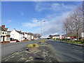
Photos of L9 5BB


Area Information
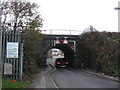
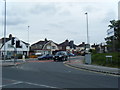
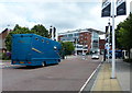
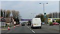
Living in L9 5BB means inhabiting a small, tightly knit residential cluster in England’s north-west, where 1,395 residents occupy a densely packed area. With a population density of 848 people per square kilometre, this postcode reflects a compact, community-focused environment. The area is defined by its proximity to key transport links, including five nearby railway stations such as Aintree and Fazakerley, which connect residents to broader regional networks. Daily life here is shaped by practical accessibility—within walking distance are retail hubs like M&S Aintree and Spar Dunningsbridge, while ferry terminals at Liverpool Pier Head offer direct links to Belfast, the Isle of Man, and Dublin. The area’s small size means a strong sense of local identity, though its limited scale also means residents must look slightly beyond for broader amenities. For those prioritising convenience over sprawling spaces, L9 5BB offers a focused, functional lifestyle.
- Area Type
- Postcode
- Area Size
- Not available
- Population
- 1395
- Population Density
- 848 people/km²
The property market in L9 5BB is dominated by owner-occupied homes, with 75% of properties in private hands. This suggests a stable, long-term resident base rather than a transient rental market. The area’s accommodation is primarily houses, which contrasts with regions where flats or apartments dominate. For buyers, this means a focus on semi-detached or terraced homes, which may appeal to those seeking space and privacy. However, the small size of the postcode means the housing stock is limited, and buyers may need to consider nearby areas for more options. The high home ownership rate also implies competitive demand, with properties likely retaining value due to their scarcity.
House Prices in L9 5BB
No properties found in this postcode.
Energy Efficiency in L9 5BB
The lifestyle in L9 5BB is shaped by its proximity to retail and transport hubs. Within walking distance are shops such as M&S Aintree, Spar Dunningsbridge, and Aldi Netherton, offering everyday essentials. The area’s ferry terminals, including Liverpool Belfast Ferry Terminal and Liverpool Pier Head Ferry Terminal, provide swift access to regional and inter-island travel, ideal for commuters or those seeking weekend getaways. While the area itself is small, its connection to larger urban centres like Liverpool ensures residents can access cultural, dining, and leisure opportunities beyond the postcode. The blend of practical retail and transport options creates a convenient, if modest, lifestyle that suits those valuing efficiency over sprawling amenities.
Amenities
Schools
| Rank | School | Type | Entry gender | Ages |
|---|
Explore more schools in this area
Go to Schools tabDemographics
The community in L9 5BB is predominantly composed of adults aged 30–64, with a median age of 47. This suggests a mature, stable population, likely with established careers and families. Home ownership is high, at 75%, and the area is characterised by houses rather than flats, indicating a preference for private, standalone properties. The predominant ethnic group is White, which aligns with broader regional demographics. The absence of specific data on deprivation means the area’s economic profile remains unquantified, but the high home ownership rate and age distribution imply a relatively secure financial base. This demographic mix supports a quiet, routine-driven lifestyle, where community ties are likely strong but not overly informal.
Household Size
Accommodation Type
Tenure
Ethnic Group
Religion
Household Composition
Age
Household Deprivation
NS-SEC
Explore more demographic insights in this area
Go to Demographics tabPlanning
Planning Constraints
- Flood RiskPremium
- Ramsar Wetland SitesPremium
- Area of Outstanding Natural BeautyPremium
- Protected Nature ReservePremium
- Protected WoodlandPremium