Area Overview for L9 5AS
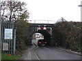
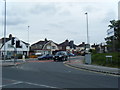
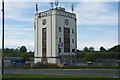
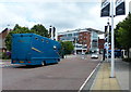
Photos of L9 5AS


Area Information
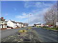
L9 5AS is a compact residential postcode in England, covering just 5.9 hectares and home to 1395 residents. With a population density of 848 people per square kilometre, it is a tightly knit community, typical of smaller urban clusters. The area’s character is shaped by its mature demographic, with a median age of 47 and a majority of residents aged 30–64. This suggests a stable, established population, many of whom own their homes—75% of properties are owner-occupied, with houses being the predominant accommodation type. Daily life here is defined by proximity to transport links, including five nearby railway stations such as Aintree and Fazakerley, and access to ferry terminals in Liverpool. While the area lacks natural conservation designations, its strategic location near major routes and amenities makes it practical for commuters. The high broadband score of 95 and solid mobile coverage of 84 support modern lifestyles, though the area’s small size means its immediate surroundings are key for additional services. For buyers, L9 5AS offers a blend of residential comfort and connectivity, though its limited size demands careful consideration of nearby options.
- Area Type
- Postcode
- Area Size
- 5.9 hectares
- Population
- 1395
- Population Density
- 848 people/km²
The property market in L9 5AS is dominated by owner-occupied homes, with 75% of properties owned by their residents. This contrasts with areas where rental demand is higher, suggesting a community focused on long-term residency rather than transient tenancies. The accommodation type is primarily houses, which is uncommon in more densely populated urban areas but typical of smaller residential clusters. This housing stock may appeal to families or individuals seeking private, standalone properties. However, the area’s limited size means the immediate surroundings are critical for additional housing options. Buyers should consider the proximity of nearby amenities and transport links, as the postcode itself offers minimal expansion. The high home ownership rate also implies a stable market, though the small population size may limit property turnover. For those seeking a quiet, established home with a focus on privacy, L9 5AS could be a viable choice, provided buyers are mindful of the area’s constraints.
House Prices in L9 5AS
Showing 9 properties
Energy Efficiency in L9 5AS
Residents of L9 5AS have access to a range of nearby amenities, including five rail stations such as Aintree and Fazakerley, which provide regular connections to Liverpool’s transport network. Retail options are limited but practical, with stores like M&S Aintree and Lidl Fazakerley offering essential shopping. The area also benefits from proximity to ferry terminals, including Liverpool Belfast and Pier Head, which open up opportunities for travel to nearby islands and cities. While the small postcode itself has minimal local parks or leisure facilities, the surrounding region likely offers more extensive options. The combination of rail, retail, and ferry access contributes to a lifestyle that balances convenience with the need to travel for broader amenities. For those prioritising ease of movement and access to regional services, the area’s transport links are a key advantage, though buyers should consider the limitations of local facilities when assessing suitability for their needs.
Amenities
Schools
| Rank | School | Type | Entry gender | Ages |
|---|
Explore more schools in this area
Go to Schools tabDemographics
The population of L9 5AS is predominantly adults aged 30–64, with a median age of 47. This reflects a mature, settled community, likely with strong family ties and long-term residency. Home ownership is high at 75%, indicating a stable housing market where most residents live in their own homes. The area is largely composed of houses, rather than flats or apartments, which aligns with the typical profile of a suburban or semi-rural postcode. The predominant ethnic group is White, though no specific data on diversity or minority populations is provided. The population density of 848 people per square kilometre suggests a moderately sized community, with enough density to support local amenities but small enough to retain a close-knit feel. The absence of detailed deprivation data means it is unclear how economic factors influence quality of life, but the high home ownership rate and age profile suggest a generally stable socioeconomic environment.
Household Size
Accommodation Type
Tenure
Ethnic Group
Religion
Household Composition
Age
Household Deprivation
NS-SEC
Explore more demographic insights in this area
Go to Demographics tabPlanning
Planning Constraints
- Flood RiskPremium
- Ramsar Wetland SitesPremium
- Area of Outstanding Natural BeautyPremium
- Protected Nature ReservePremium
- Protected WoodlandPremium