Area Overview for L9 2DQ
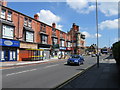
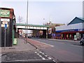
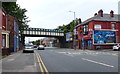
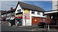
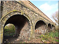
Photos of L9 2DQ


Area Information
Living in L9 2DQ means being part of a small, tightly knit residential cluster in England, home to 1,711 residents. This area is defined by its compact size and proximity to essential services, making it ideal for those seeking a balance between suburban comfort and urban accessibility. The community is predominantly composed of adults aged 30–64, with a median age of 47, reflecting a mature, stable population. Daily life here is shaped by the presence of nearby schools, retail outlets, and transport links, ensuring convenience for families and professionals alike. The area’s small footprint means a strong sense of local identity, with residents likely to know their neighbours and engage with the immediate surroundings. While it lacks the density of larger cities, L9 2DQ offers a quieter, more manageable environment, with homes primarily in the form of individual houses. For those prioritising safety and practicality, the area’s low flood risk and proximity to rail and ferry services add to its appeal.
- Area Type
- Postcode
- Area Size
- Not available
- Population
- 1711
- Population Density
- 3406 people/km²
The property market in L9 2DQ is dominated by owner-occupied homes, with 59% of residents owning their properties. This indicates a stable, low-turnover market where houses are the primary accommodation type. The absence of flats or rental properties suggests a community prioritising private, long-term ownership. For buyers, this means a focus on individual homes rather than apartments, which may appeal to those seeking space and autonomy. The small area’s limited size means the housing stock is likely to be tightly concentrated, with properties situated close to local amenities. While the data does not specify property prices or trends, the high home ownership rate suggests a resilient market, potentially offering value for those seeking a quiet, family-friendly environment with easy access to schools and transport.
House Prices in L9 2DQ
No properties found in this postcode.
Energy Efficiency in L9 2DQ
The lifestyle in L9 2DQ is shaped by its proximity to a range of amenities. Retail options include Iceland Walton, Tesco Fazakerley, and Farmfoods Orrell, offering everyday shopping needs. Rail stations such as Orrell Park, Rice Lane, and Walton provide easy access to commuting and regional travel, while ferry terminals at Liverpool Belfast, Isle of Man & Dublin, and Pier Head connect residents to nearby cities and islands. The area’s small size means these amenities are within practical reach, supporting a convenient, active lifestyle. For families, the cluster of primary schools and nurseries ensures children’s needs are met locally. The combination of retail, transport, and educational facilities creates a self-contained environment where daily life is efficient and accessible.
Amenities
Schools
Residents of L9 2DQ have access to several primary schools, including Longmoor Infant and Nursery School, Rice Lane Junior School, Rice Lane Infant and Nursery School, St John the Evangelist’s Primary School, and Rice Lane Primary School and Nursery, which holds an Ofsted rating of ‘good’. This concentration of primary schools ensures that families with young children have multiple options within close proximity. The presence of multiple infant and junior schools suggests a well-structured educational pathway for children from early years through to primary education. For parents, the variety of schools may allow for choices based on specific needs, such as nursery provision or academic focus. The ‘good’ rating at Rice Lane Primary School and Nursery indicates a school that meets quality standards, offering reassurance for families prioritising education.
| Rank | School | Type | Entry gender | Ages |
|---|
Explore more schools in this area
Go to Schools tabDemographics
The community in L9 2DQ is predominantly composed of adults aged 30–64, with a median age of 47. This suggests a mature population, likely with established careers and families. Home ownership is strong, with 59% of residents owning their homes, indicating a stable housing market. The area is characterised by houses rather than flats, reflecting a preference for private, standalone living spaces. The predominant ethnic group is White, though specific data on diversity or deprivation is not provided. The age profile and ownership rates suggest a community focused on long-term residency, with fewer transient residents. For those considering L9 2DQ, the demographic profile implies a neighbourhood where local amenities and services are likely to cater to the needs of middle-aged adults and their families.
Household Size
Accommodation Type
Tenure
Ethnic Group
Religion
Household Composition
Age
Household Deprivation
NS-SEC
Explore more demographic insights in this area
Go to Demographics tabPlanning
Planning Constraints
- Flood RiskPremium
- Ramsar Wetland SitesPremium
- Area of Outstanding Natural BeautyPremium
- Protected Nature ReservePremium
- Protected WoodlandPremium