Area Overview for L9 2BZ
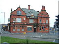
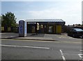
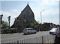
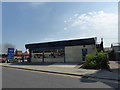
Photos of L9 2BZ
Area Information
Living in L9 2BZ means being part of a small, tightly knit residential cluster in England, home to 1,711 people. This area is characterised by its modest scale and proximity to essential services, making it a practical choice for those seeking a balance between suburban comfort and accessibility. The community is predominantly composed of adults aged 30–64, with a median age of 47, suggesting a stable, family-oriented demographic. While the area is not expansive, its layout ensures that amenities and transport links are within practical reach. Residents benefit from a mix of retail, rail, and ferry connections, including major supermarkets like Tesco Fazakerley and nearby railway stations. The presence of multiple primary schools, including Rice Lane Primary School and Nursery with a ‘good’ Ofsted rating, underscores the area’s appeal to families. However, the small population and limited housing stock mean that L9 2BZ is not a high-density area, offering a quieter, more intimate living experience compared to larger urban centres.
- Area Type
- Postcode
- Area Size
- Not available
- Population
- 1711
- Population Density
- 3406 people/km²
The property market in L9 2BZ is defined by its low density and focus on owner-occupied homes. With 59% of residents owning their homes, this area is not a rental hotspot but rather a place where families and long-term residents have established roots. The predominant accommodation type is houses, which suggests a mix of semi-detached and detached properties typical of suburban settings. Given the small population and limited housing stock, the market is unlikely to be highly competitive, though buyers should consider the area’s restricted size. The presence of multiple rail stations, including Orrell Park and Rice Lane, may enhance property value by improving connectivity. However, the lack of significant planning constraints or protected sites means that development pressure is minimal, preserving the area’s character. For buyers, this translates to a niche market where properties are likely to remain in the same hands for extended periods.
House Prices in L9 2BZ
No properties found in this postcode.
Energy Efficiency in L9 2BZ
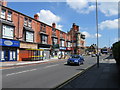
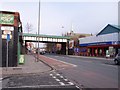
Lifestyle in L9 2BZ is shaped by its proximity to retail, transport, and leisure options. Residents have access to major supermarkets such as Tesco Fazakerley and Farmfoods Orrell, ensuring everyday shopping needs are met without long journeys. The area’s rail stations, including Rice Lane and Walton, provide easy access to urban centres, while ferry terminals like Liverpool Belfast and Pier Head offer connections to nearby cities and islands. Though the data does not mention parks or recreational spaces, the absence of protected natural sites suggests that green spaces may be limited. The community’s character is defined by its practical amenities, with a focus on convenience over luxury. For those who prioritise ease of access to services and transport, L9 2BZ offers a straightforward, no-frills lifestyle. However, the lack of detailed information on leisure facilities means that residents may need to explore beyond the immediate area for cultural or recreational activities.
Amenities
Schools
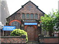
Residents of L9 2BZ have access to a range of primary schools, including Longmoor Infant and Nursery School, Rice Lane Infant and Nursery School, and St John the Evangelist’s Primary School. Rice Lane Primary School and Nursery stands out with a ‘good’ Ofsted rating, offering families a reliable option for early education. The concentration of primary schools suggests that the area is well-served for younger children, though no secondary schools are listed in the data. This mix of schools provides flexibility for parents, allowing them to choose between smaller, local nurseries and larger primary institutions. The proximity of these schools to homes reduces commuting time for families, reinforcing the area’s appeal to those prioritising convenience. However, the absence of secondary education options within the immediate vicinity may require families to look further afield for secondary schooling.
| Rank | School | Type | Entry gender | Ages |
|---|
Explore more schools in this area
Go to Schools tabDemographics
The community in L9 2BZ is predominantly composed of adults aged 30–64, with a median age of 47. This suggests a mature population, likely with established careers and families. Home ownership stands at 59%, indicating that nearly six in 10 residents live in properties they own, rather than renting. The accommodation type is primarily houses, which aligns with the area’s small, residential character. The predominant ethnic group is White, though no further breakdown of diversity is provided. The absence of specific data on deprivation or income levels means that quality of life factors such as access to services and safety must be inferred from available metrics. For instance, the area’s broadband score of 99 and rail connectivity suggest a reasonable standard of living, though crime risk is rated as medium. These factors collectively shape a community that is stable but not without its challenges.
Household Size
Accommodation Type
Tenure
Ethnic Group
Religion
Household Composition
Age
Household Deprivation
NS-SEC
Explore more demographic insights in this area
Go to Demographics tabPlanning
Planning Constraints
- Flood RiskPremium
- Ramsar Wetland SitesPremium
- Area of Outstanding Natural BeautyPremium
- Protected Nature ReservePremium
- Protected WoodlandPremium