Area Overview for L9 2AY
Photos of L9 2AY

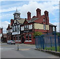
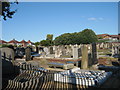
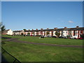
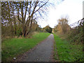
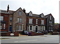
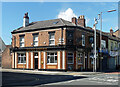
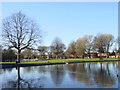
24 photos from this area
Area Information
Key information about the L9 2AY including its size, population, and administrative classification.
- Area Type
- Postcode
- Area Size
- 8727 m²
- Population
- 1664
- Population Density
- 9864 people/km²
House Prices in L9 2AY
34
Properties
£109,715
Average Sold Price
£25,000
Lowest Price
£175,510
Highest Price
Showing 34 properties
| Address | Type | Beds | Baths | Last Sale Price | Last Sale Date | |
|---|---|---|---|---|---|---|
| 75 Stalmine Road, Liverpool, L9 2AY | Terraced | 3 | 1 | £120,000 | Feb 2025 | |
| 91 Stalmine Road, Liverpool, L9 2AY | Terraced | 3 | 1 | £125,000 | Jan 2025 | |
| 123 Stalmine Road, Liverpool, L9 2AY | Terraced | 3 | 1 | £98,177 | Jun 2024 | |
| 97 Stalmine Road, Liverpool, L9 2AY | Terraced | 3 | 1 | £126,950 | Oct 2023 | |
| 113 Stalmine Road, Liverpool, L9 2AY | Terraced | 3 | 1 | £142,000 | Jul 2022 | |
| 73 Stalmine Road, Liverpool, L9 2AY | Terraced | 3 | 1 | £175,510 | Apr 2022 | |
| 105 Stalmine Road, Liverpool, L9 2AY | house | 3 | 1 | £106,000 | Apr 2022 | |
| 109 Stalmine Road, Liverpool, L9 2AY | house | - | - | £145,000 | Feb 2022 | |
| 99 Stalmine Road, Liverpool, L9 2AY | Terraced | 3 | 1 | £112,000 | Jan 2022 | |
| 131 Stalmine Road, Liverpool, L9 2AY | house | - | - | £165,000 | Aug 2021 |
Page 1 of 4
Energy Efficiency in L9 2AY
Amenities
Schools
| Rank | School | Type | Entry gender | Ages |
|---|
Explore more schools in this area
Go to Schools tabDemographics
Household Size
Family (3-5 people)
most common
Accommodation Type
Houses
most common
Tenure
67
majority
Ethnic Group
White
most common
Religion
N/A
most common
Household Composition
N/A
most common
Age
47
median
Adults (30-64 years)
most common
Household Deprivation
N/A
with no deprivation
NS-SEC
26
in Lower managerial occupations
Explore more demographic insights in this area
Go to Demographics tabPlanning
Planning Constraints
- Flood RiskPremium
- Ramsar Wetland SitesPremium
- Area of Outstanding Natural BeautyPremium
- Protected Nature ReservePremium
- Protected WoodlandPremium