Area Overview for L9 0NX
Photos of L9 0NX
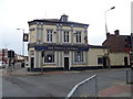
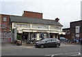
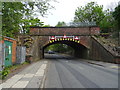
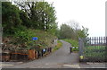
45 photos from this area
Area Information
Key information about the L9 0NX including its size, population, and administrative classification.
- Area Type
- Postcode
- Area Size
- 1.1 hectares
- Population
- 1616
- Population Density
- 5399 people/km²
House Prices in L9 0NX
26
Properties
£141,884
Average Sold Price
£33,800
Lowest Price
£269,950
Highest Price
Showing 26 properties
| Address | Type | Beds | Baths | Last Sale Price | Last Sale Date | |
|---|---|---|---|---|---|---|
| 21 Kilmore Close, Liverpool, L9 0NX | house | - | - | £250,000 | Mar 2025 | |
| 5 Kilmore Close, Liverpool, L9 0NX | Semi-detached | 2 | 1 | £181,000 | Oct 2024 | |
| 2 Kilmore Close, Liverpool, L9 0NX | house | - | - | £180,000 | Apr 2024 | |
| 12 Kilmore Close, Liverpool, L9 0NX | Detached | 2 | 1 | £223,000 | Dec 2022 | |
| 17 Kilmore Close, Liverpool, L9 0NX | Detached | 4 | 2 | £269,950 | Dec 2017 | |
| 9 Kilmore Close, Liverpool, L9 0NX | Semi-detached | 3 | 1 | £140,000 | Jul 2017 | |
| 26 Kilmore Close, Liverpool, L9 0NX | Semi-detached | 3 | - | £139,000 | Feb 2016 | |
| 15 Kilmore Close, Liverpool, L9 0NX | house | - | - | £170,000 | Mar 2014 | |
| 3 Kilmore Close, Liverpool, L9 0NX | Semi-detached | 3 | 1 | £148,000 | Aug 2012 | |
| 6 Kilmore Close, Liverpool, L9 0NX | Semi-detached | - | - | £119,995 | Mar 2006 |
Page 1 of 3
Energy Efficiency in L9 0NX
Amenities
Schools
| Rank | School | Type | Entry gender | Ages |
|---|
Explore more schools in this area
Go to Schools tabDemographics
Household Size
Family (3-5 people)
most common
Accommodation Type
Houses
most common
Tenure
86
majority
Ethnic Group
White
most common
Religion
N/A
most common
Household Composition
N/A
most common
Age
47
median
Adults (30-64 years)
most common
Household Deprivation
N/A
with no deprivation
NS-SEC
37
in Lower managerial occupations
Explore more demographic insights in this area
Go to Demographics tabPlanning
Planning Constraints
- Flood RiskPremium
- Ramsar Wetland SitesPremium
- Area of Outstanding Natural BeautyPremium
- Protected Nature ReservePremium
- Protected WoodlandPremium