Area Overview for L9 0EJ
Photos of L9 0EJ
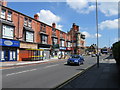


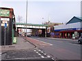


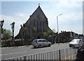

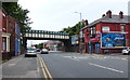
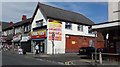
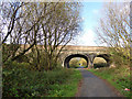
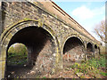
69 photos from this area
Area Information
Key information about the L9 0EJ including its size, population, and administrative classification.
- Area Type
- Postcode
- Area Size
- 3813 m²
- Population
- 1120
- Population Density
- 8537 people/km²
House Prices in L9 0EJ
27
Properties
£56,253
Average Sold Price
£9,000
Lowest Price
£124,920
Highest Price
Showing 27 properties
| Address | Type | Beds | Baths | Last Sale Price | Last Sale Date | |
|---|---|---|---|---|---|---|
| 124 Longmoor Lane, Liverpool Nine, Liverpool, L9 0EJ | Terraced | 2 | 1 | £70,000 | Oct 2022 | |
| 144 Longmoor Lane, Liverpool Nine, Liverpool, L9 0EJ | house | 6 | 6 | £120,000 | Apr 2020 | |
| 150 Longmoor Lane, Liverpool Nine, Liverpool, L9 0EJ | house | - | - | £124,920 | Mar 2008 | |
| 146 Longmoor Lane, Liverpool Nine, Liverpool, L9 0EJ | Terraced | - | - | £19,750 | Apr 2001 | |
| 120 Longmoor Lane, Liverpool Nine, Liverpool, L9 0EJ | Land | - | - | £30,000 | Mar 2000 | |
| 140 Longmoor Lane, Liverpool Nine, Liverpool, L9 0EJ | Flat | - | - | £20,100 | Apr 1999 | |
| 122 Longmoor Lane, Liverpool Nine, Liverpool, L9 0EJ | Terraced | 2 | - | £9,000 | Sep 1995 | |
| 110 Longmoor Lane, Liverpool Nine, Liverpool, L9 0EJ | Land | 6 | - | - | - | |
| 104A Longmoor Lane, Liverpool Nine, Liverpool, L9 0EJ | Flat | - | - | - | - | |
| 116A Longmoor Lane, Liverpool Nine, Liverpool, L9 0EJ | Flat | - | - | - | - |
Page 1 of 3
Energy Efficiency in L9 0EJ
Amenities
Schools
| Rank | School | Type | Entry gender | Ages |
|---|
Explore more schools in this area
Go to Schools tabDemographics
Household Size
One person
most common
Accommodation Type
Houses
most common
Tenure
55
majority
Ethnic Group
White
most common
Religion
N/A
most common
Household Composition
N/A
most common
Age
47
median
Adults (30-64 years)
most common
Household Deprivation
N/A
with no deprivation
NS-SEC
21
in Lower managerial occupations
Explore more demographic insights in this area
Go to Demographics tabPlanning
Planning Constraints
- Flood RiskPremium
- Ramsar Wetland SitesPremium
- Area of Outstanding Natural BeautyPremium
- Protected Nature ReservePremium
- Protected WoodlandPremium