Area Overview for L9 0EG
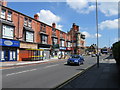
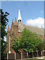
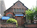
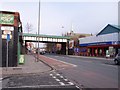
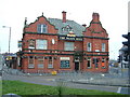
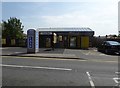
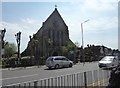
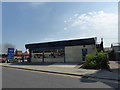
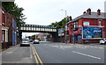
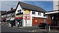
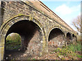
Photos of L9 0EG

Area Information
Living in L9 0EG offers a compact, residential experience within a small cluster of homes in England. The area spans 1,449 square metres and is home to 1,337 residents, resulting in a high population density of 922,765 people per square kilometre. This suggests a tightly knit community, though the area’s size means it is more of a focused neighbourhood than a sprawling suburb. Daily life here is likely characterised by proximity to essential services, with nearby amenities such as retail stores, railway stations, and ferry terminals within practical reach. The area’s demographic profile—primarily adults aged 30–64—hints at a mature, stable population, many of whom may have established careers and families. While the data does not specify local landmarks or cultural features, the presence of multiple schools and transport links indicates a practical, functional lifestyle. For buyers, L9 0EG presents a chance to live in a well-connected, residential postcode with a clear focus on housing over commercial development.
- Area Type
- Postcode
- Area Size
- 1449 m²
- Population
- 1337
- Population Density
- 5325 people/km²
The property market in L9 0EG is largely driven by owner-occupation, with 70% of residents owning their homes. The accommodation type is exclusively houses, suggesting a lack of flats or apartments in the area. This makes L9 0EG a small, focused postcode where housing stock is limited to single-family homes. For buyers, this means the market is likely to be competitive, with limited options for rental properties or alternative housing types. The high home ownership rate may indicate a long-term, settled community, which could influence property values and demand. Given the area’s size and proximity to amenities like schools and transport links, it may appeal to those seeking a residential location with practical access to services. However, the small scale of the area means buyers should consider the immediate surroundings for broader property options.
House Prices in L9 0EG
Showing 2 properties
| Address | Type | Beds | Baths | Last Sale Price | Last Sale Date | |
|---|---|---|---|---|---|---|
| Top Floor Flat, National Westminster Bank Plc, Longmoor Lane, Liverpool Nine, Liverpool, L9 0EG | Flat | - | - | - | - | |
| Natwest, National Westminster Bank Plc, Longmoor Lane, Liverpool Nine, Liverpool, L9 0EG | retail_financial | - | - | - | - |
Energy Efficiency in L9 0EG
The lifestyle in L9 0EG is supported by a range of nearby amenities, including retail outlets like Tesco Fazakerley, Iceland Walton, and Farmfoods Orrell, which provide essential shopping options. The area’s proximity to rail stations such as Orrell Park and Walton, as well as ferry terminals in Liverpool, ensures convenient access to transport networks. These facilities contribute to a practical, functional daily life, with residents able to shop, commute, and travel with ease. While the data does not specify parks or leisure facilities, the presence of multiple schools and transport links suggests a community-oriented environment. The combination of retail, transport, and educational amenities makes L9 0EG a location where practicality and accessibility are prioritised, supporting both routine needs and broader mobility.
Amenities
Schools
Residents of L9 0EG have access to several primary schools within the vicinity, including Longmoor Junior School, Blessed Sacrament Catholic Junior School, and Blessed Sacrament Catholic Infant School. The Longmoor Community Primary School holds an Ofsted rating of ‘good’, while the Blessed Sacrament Catholic Primary School is rated ‘outstanding’. These schools provide a range of educational options for families, with the ‘outstanding’ rating suggesting high-quality teaching and facilities. The presence of multiple primary schools indicates a focus on early education, which may be particularly important for families with young children. The mix of Catholic and non-denominational schools offers flexibility in choosing a school that aligns with family values or practical needs. For homebuyers, proximity to these schools could be a key consideration, as it enhances the area’s appeal for families.
| Rank | School | Type | Entry gender | Ages |
|---|
Explore more schools in this area
Go to Schools tabDemographics
The community in L9 0EG is predominantly composed of adults aged 30–64, with a median age of 47. This suggests a population skewed towards middle-aged individuals, likely many of whom are homeowners. Home ownership here is high, at 70%, and the accommodation type is primarily houses, indicating a residential area with a focus on single-family homes rather than flats or shared housing. The predominant ethnic group is White, though the data does not provide further breakdowns of diversity or deprivation levels. The age profile implies a community with established careers and families, which may influence local dynamics such as school demand and social activities. With 70% of residents owning their homes, the area may have a stable, long-term population rather than a transient one. This demographic structure could shape the character of the neighbourhood, with a focus on family-oriented living and community continuity.
Household Size
Accommodation Type
Tenure
Ethnic Group
Religion
Household Composition
Age
Household Deprivation
NS-SEC
Explore more demographic insights in this area
Go to Demographics tabPlanning
Planning Constraints
- Flood RiskPremium
- Ramsar Wetland SitesPremium
- Area of Outstanding Natural BeautyPremium
- Protected Nature ReservePremium
- Protected WoodlandPremium