Area Overview for L8 9TA
Photos of L8 9TA
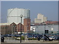
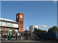
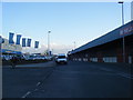
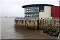
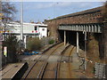
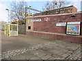
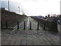
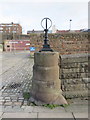
72 photos from this area
Area Information
Key information about the L8 9TA including its size, population, and administrative classification.
- Area Type
- Postcode
- Area Size
- 4493 m²
- Population
- 1276
- Population Density
- 2656 people/km²
House Prices in L8 9TA
38
Properties
£115,250
Average Sold Price
£32,000
Lowest Price
£185,500
Highest Price
Showing 38 properties
| Address | Type | Beds | Baths | Last Sale Price | Last Sale Date | |
|---|---|---|---|---|---|---|
| 465 Grafton Street, Liverpool, L8 9TA | house | 2 | 1 | £166,500 | May 2025 | |
| 463 Grafton Street, Liverpool, L8 9TA | Terraced | 2 | 2 | £147,500 | Apr 2025 | |
| 473 Grafton Street, Liverpool, L8 9TA | Terraced | 2 | 1 | £127,000 | Oct 2024 | |
| 497 Grafton Street, Liverpool, L8 9TA | Terraced | 3 | 1 | £185,500 | Sep 2024 | |
| 475 Grafton Street, Liverpool, L8 9TA | Terraced | 2 | 1 | £162,500 | Jun 2024 | |
| 499 Grafton Street, Liverpool, L8 9TA | Terraced | 2 | 1 | £179,000 | Nov 2022 | |
| 455 Grafton Street, Liverpool, L8 9TA | Terraced | 2 | 1 | £130,000 | Nov 2022 | |
| 449 Grafton Street, Liverpool, L8 9TA | Terraced | 2 | 1 | £120,000 | Sep 2022 | |
| 467 Grafton Street, Liverpool, L8 9TA | Terraced | 3 | 1 | £127,000 | Apr 2022 | |
| 469 Grafton Street, Liverpool, L8 9TA | Terraced | 2 | 1 | £120,000 | Jul 2020 |
Page 1 of 4
Energy Efficiency in L8 9TA
Amenities
Schools
| Rank | School | Type | Entry gender | Ages |
|---|
Explore more schools in this area
Go to Schools tabDemographics
Household Size
One person
most common
Accommodation Type
Houses
most common
Tenure
61
majority
Ethnic Group
White
most common
Religion
N/A
most common
Household Composition
N/A
most common
Age
47
median
Adults (30-64 years)
most common
Household Deprivation
N/A
with no deprivation
NS-SEC
32
in Lower managerial occupations
Explore more demographic insights in this area
Go to Demographics tabPlanning
Planning Constraints
- Flood RiskPremium
- Ramsar Wetland SitesPremium
- Area of Outstanding Natural BeautyPremium
- Protected Nature ReservePremium
- Protected WoodlandPremium