Area Overview for L8 4YJ
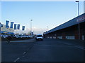
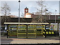
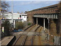
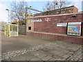
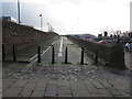
Photos of L8 4YJ


Area Information
Living in L8 4YJ means inhabiting a compact, densely populated residential cluster in England. The area covers just 1,706 square metres, yet it supports a population of 1,784 people, resulting in a population density of over 1 million per square kilometre. This suggests a tightly knit community, though the small size means the area is likely to feel intimate rather than sprawling. The postcode is typical of urban or semi-urban settings, with homes concentrated in a limited space. While no specific landmarks or historical context are provided, the data indicates a focus on residential living, with no mention of industrial or commercial zones. Daily life here would revolve around nearby amenities, schools, and transport links, which are critical for residents given the area’s density. The presence of multiple rail stations and ferry terminals nearby suggests strong connectivity to surrounding regions, which could influence both employment opportunities and leisure activities. For those considering L8 4YJ, the key appeal lies in its proximity to services and transport, though the small footprint means the area is not expansive.
- Area Type
- Postcode
- Area Size
- 1706 m²
- Population
- 1784
- Population Density
- 8784 people/km²
The property market in L8 4YJ is characterised by a low home ownership rate of 28%, suggesting that the majority of housing stock is rented rather than owned. This could indicate a rental market with limited opportunities for long-term investment in property. The accommodation type is predominantly houses, which is unusual for a high-density postcode. This may reflect a mix of older, larger homes or semi-detached properties, which are less common in compact urban areas. For buyers, this suggests that available properties may be limited in number and potentially more expensive relative to the area’s size. The small footprint of L8 4YJ means the immediate surroundings are critical for property searches, with nearby areas likely to offer more options. However, the data does not indicate whether property values are rising or falling, so potential buyers should consider broader regional trends.
House Prices in L8 4YJ
Showing 18 properties
| Address | Type | Beds | Baths | Last Sale Price | Last Sale Date | |
|---|---|---|---|---|---|---|
| 359 Mill Street, Dingle, Liverpool, L8 4YJ | house | - | - | - | - | |
| 353 Mill Street, Dingle, Liverpool, L8 4YJ | house | - | - | - | - | |
| 355 Mill Street, Dingle, Liverpool, L8 4YJ | house | - | - | - | - | |
| 351 Mill Street, Dingle, Liverpool, L8 4YJ | house | - | - | - | - | |
| 357 Mill Street, Dingle, Liverpool, L8 4YJ | house | - | - | - | - | |
| Apartment 2, 349 Mill Street, Dingle, Liverpool, L8 4YJ | Flat | - | - | - | - | |
| Apartment 3, 349 Mill Street, Dingle, Liverpool, L8 4YJ | Flat | - | - | - | - | |
| Apartment 9, 349 Mill Street, Dingle, Liverpool, L8 4YJ | Flat | - | - | - | - | |
| Apartment 14, 349 Mill Street, Dingle, Liverpool, L8 4YJ | Flat | - | - | - | - | |
| Apartment 5, 349 Mill Street, Dingle, Liverpool, L8 4YJ | Flat | - | - | - | - |
Energy Efficiency in L8 4YJ
The lifestyle in L8 4YJ is shaped by its proximity to a range of amenities. Retail options include Tesco Park, Lidl Park, and Spar, providing everyday shopping convenience. Rail stations like Brunswick and St Michaels offer easy access to regional transport networks, while ferry terminals connect to Birkenhead, the Isle of Man, and Dublin. Two airports, both Liverpool John Lennon Airport, are nearby, facilitating travel to and from major cities. The area’s compact size means these amenities are within practical reach, reducing the need for long commutes. The mix of retail, transport, and ferry options suggests a community that prioritises accessibility and connectivity. For residents, this translates to a lifestyle where daily needs can be met locally, though the high density may mean shared spaces or limited private outdoor areas.
Amenities
Schools
Residents of L8 4YJ have access to two primary schools: Parkhill Primary School and Beaufort Park Primary School. Both are likely to serve the local community, though no Ofsted ratings or academic performance data are provided. The presence of two primary schools suggests that the area is well-served for early education, which is a key consideration for families. Given the median age of 47 and the prevalence of adults aged 30–64, these schools may cater to children of working-age parents. However, the lack of secondary school information means families with older children may need to look beyond the immediate area for further education. The availability of primary schools aligns with the demographic profile of the area, reinforcing its appeal to households with children.
| Rank | School | Type | Entry gender | Ages |
|---|
Explore more schools in this area
Go to Schools tabDemographics
The community in L8 4YJ is predominantly composed of adults aged 30–64, with a median age of 47. This suggests a mature, stable population, likely with established careers and family structures. Home ownership rates are low at 28%, indicating that a significant proportion of residents rent their homes. The accommodation type is primarily houses, which is uncommon in high-density areas, hinting at a mix of detached or semi-detached properties. The predominant ethnic group is White, though no data is provided on other ethnicities or diversity levels. The age profile and home ownership statistics suggest a community that may be less transient than areas with higher rental turnover. However, the lack of data on deprivation or socioeconomic status means it is unclear how this affects quality of life. The presence of primary schools nearby implies a focus on family living, aligning with the age range of residents.
Household Size
Accommodation Type
Tenure
Ethnic Group
Religion
Household Composition
Age
Household Deprivation
NS-SEC
Explore more demographic insights in this area
Go to Demographics tabPlanning
Planning Constraints
- Flood RiskPremium
- Ramsar Wetland SitesPremium
- Area of Outstanding Natural BeautyPremium
- Protected Nature ReservePremium
- Protected WoodlandPremium