Area Overview for L7 7DE
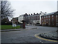
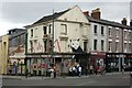
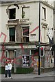
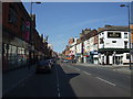
Photos of L7 7DE


Area Information
Living in L7 7DE means being part of a small, tightly knit residential cluster in England, home to 2,266 people. This area is defined by its compact size and proximity to key urban hubs, offering a blend of convenience and community. The population is predominantly young adults, with a median age of 22, reflecting a dynamic, student-influenced demographic. While the area is small, it is well-served by transport links and amenities that cater to daily needs. Residents benefit from nearby schools, including a primary school and a sixth-form institution, which support families at different stages of education. The housing stock is largely composed of flats, reflecting a rental market that dominates over owner-occupation. This makes L7 7DE a practical choice for those seeking affordable, accessible living without the constraints of larger urban sprawl. The area’s character is shaped by its proximity to Liverpool’s transport networks, including rail and ferry services, which connect residents to broader regional opportunities. Despite its modest size, L7 7DE offers a functional, if unassuming, lifestyle for those prioritising location over sprawling suburban comforts.
- Area Type
- Postcode
- Area Size
- Not available
- Population
- 2266
- Population Density
- 7973 people/km²
The property market in L7 7DE is characterised by a low home ownership rate of 23%, which suggests that the area is primarily a rental market rather than one dominated by owner-occupied homes. The accommodation type is predominantly flats, reflecting the compact, urban nature of the postcode. This housing stock is likely to cater to students, young professionals, and those seeking affordable, short-term living solutions. The limited availability of owner-occupied properties means that buyers may find fewer options in L7 7DE itself, though the surrounding areas might offer more variety. For those considering purchasing, the flat-based market may present challenges in terms of long-term value appreciation, as flats in such areas often have lower capital growth potential compared to detached or semi-detached homes. The small size of L7 7DE also means that the immediate vicinity is critical for buyers seeking additional properties, requiring a broader search beyond the postcode boundary.
House Prices in L7 7DE
No properties found in this postcode.
Energy Efficiency in L7 7DE
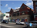
The lifestyle in L7 7DE is shaped by its proximity to a range of amenities that cater to daily needs. Retail options include major chains like Tesco Myrtle, Heron Liverpool, and Co-op Liverpool, providing access to groceries, clothing, and household essentials. The area’s rail network, with stations such as Liverpool Central Loop Line and Edge Hill, ensures easy travel to Liverpool’s city centre and surrounding suburbs. Ferry services, including Liverpool Pier Head Terminal and Woodside Birkenhead, offer additional transport links, particularly for those reliant on waterways for commuting or leisure. While the data does not specify parks or leisure facilities, the presence of multiple retail and transport hubs suggests a focus on convenience over expansive recreational spaces. This makes L7 7DE ideal for those prioritising accessibility and practicality, though those seeking larger green spaces may need to look further afield. The compact nature of the area ensures that essential services are within walking or short transit distance, enhancing the overall convenience of daily life.
Amenities
Schools
Residents of L7 7DE have access to two notable educational institutions within practical reach. St Saviour’s CofE Junior Mixed and Infant School serves the primary education needs of local children, offering a mixed-gender environment for younger students. Nearby, the University of Liverpool Mathematics School caters to sixth-form students, specialising in mathematics and providing advanced academic pathways. This combination of primary and post-16 education options makes L7 7DE a viable choice for families with children at different stages of schooling. The presence of a specialist sixth-form college suggests a focus on academic excellence in STEM fields, which could appeal to parents prioritising rigorous academic training. However, the data does not provide Ofsted ratings or performance metrics for these schools, so prospective families should conduct further research to assess their suitability. The proximity of these institutions reduces the need for long commutes, enhancing the area’s appeal for education-focused households.
| Rank | School | Type | Entry gender | Ages |
|---|
Explore more schools in this area
Go to Schools tabDemographics
The community in L7 7DE is overwhelmingly young, with a median age of 22 and the majority of residents aged between 15 and 29. This demographic skew suggests a population shaped by students, graduates, and young professionals. Home ownership is low, with only 23% of households owning their properties, indicating a rental-dominated market. The accommodation type is predominantly flats, which aligns with the area’s compact nature and the needs of transient or budget-conscious residents. The predominant ethnic group is White, though no specific data on diversity or deprivation is provided. The age profile and housing stock suggest a transient community, likely influenced by nearby educational institutions and employment opportunities. For those considering L7 7DE, the low home ownership rate and flat-based housing stock mean the area is more suited to renters than long-term buyers seeking family homes. The youthful population also implies a focus on social and educational amenities over traditional family-oriented infrastructure.
Household Size
Accommodation Type
Tenure
Ethnic Group
Religion
Household Composition
Age
Household Deprivation
NS-SEC
Explore more demographic insights in this area
Go to Demographics tabPlanning
Planning Constraints
- Flood RiskPremium
- Ramsar Wetland SitesPremium
- Area of Outstanding Natural BeautyPremium
- Protected Nature ReservePremium
- Protected WoodlandPremium