Area Overview for L7 0LX
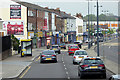
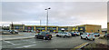
Photos of L7 0LX


Area Information
Living in L7 0LX offers a compact, residential experience in a small cluster of homes. With a population of 2,510, the area is characterised by a mature demographic, where the median age is 47 and the majority of residents are adults aged 30–64. This suggests a community rooted in stability, with many long-term residents. The area is primarily composed of houses, reflecting a more traditional housing stock compared to high-density developments. Daily life here is shaped by proximity to key amenities, including retail outlets like Lidl Edge and M&S Liverpool, as well as transport links such as Wavertree Technology Park Railway Station and Liverpool John Lennon Airport. While the area lacks natural constraints like protected woodlands or AONB coverage, its appeal lies in practical accessibility and a mix of local and regional connectivity. However, residents should be mindful of the area’s high crime risk, which is above average. For those seeking a quiet, established neighbourhood with straightforward access to services, L7 0LX presents a focused option.
- Area Type
- Postcode
- Area Size
- Not available
- Population
- 2510
- Population Density
- 4692 people/km²
The property market in L7 0LX is defined by a 38% home ownership rate, indicating that over two-thirds of residents are likely to be renting. This suggests a rental-focused market, which could influence property availability and pricing. The area’s accommodation type is predominantly houses, which is atypical for modern urban settings but may reflect its historical development. For buyers, this means a limited inventory of owner-occupied homes, potentially making the market more competitive for those seeking to purchase. The small size of the area and its immediate surroundings may also mean that property searches need to extend beyond L7 0LX itself. The mix of houses and rental demand could create a dynamic where investors or first-time buyers face challenges in finding suitable options. However, the absence of planning constraints like protected nature reserves or AONB coverage may make the area more adaptable for development or renovation.
House Prices in L7 0LX
No properties found in this postcode.
Energy Efficiency in L7 0LX
Lifestyle in L7 0LX is shaped by its proximity to a range of amenities. Retail options include Lidl Edge and Farmfoods Old, offering everyday shopping convenience. The area’s rail network, with stations like Broad Green and Edge Hill, provides easy access to nearby towns and cities, while ferry terminals connect to Liverpool’s waterfront and beyond. The presence of Liverpool John Lennon Airport adds to the area’s accessibility for travel. For leisure, the nearby schools and open spaces (though not named in the data) suggest opportunities for family activities. The mix of retail, transport, and regional connectivity creates a practical living environment, though the lack of detailed information on parks or leisure facilities limits a full picture. Overall, residents benefit from a blend of local services and broader regional links.
Amenities
Schools
The schools near L7 0LX include Birchfield Primary School, Birchfield County Infant School, Phoenix Primary School, and Nazene Danielle School of Performing Arts. Phoenix Primary School and Nazene Danielle School both hold an Ofsted rating of ‘good’, offering families a range of educational choices. The presence of two primary schools suggests a focus on early education, while the independent Nazene Danielle School provides an alternative for those seeking specialist arts-based learning. The mix of state and independent institutions reflects a diverse educational landscape, catering to different priorities. Families with children may benefit from the proximity to these schools, though the area’s small size means competition for places could be keen. The ‘good’ Ofsted ratings indicate that at least some schools meet or exceed standards, which is a positive factor for prospective residents.
| Rank | School | Type | Entry gender | Ages |
|---|
Explore more schools in this area
Go to Schools tabDemographics
The community in L7 0LX is predominantly composed of adults aged 30–64, with a median age of 47. This indicates a mature population, likely with long-term ties to the area. Home ownership stands at 38%, suggesting a significant proportion of residents are renters, which may reflect the area’s housing dynamics. The accommodation type is primarily houses, which is unusual in modern developments but aligns with the area’s small, residential character. The predominant ethnic group is White, though no specific data on diversity or deprivation is provided. The age profile suggests a mix of families and individuals in middle to later life, potentially influencing local services and amenities. The 38% home ownership rate implies a rental market that could affect property values and investment opportunities. This demographic profile shapes a community with a focus on stability and established living, though the lack of detailed diversity data limits further analysis.
Household Size
Accommodation Type
Tenure
Ethnic Group
Religion
Household Composition
Age
Household Deprivation
NS-SEC
Explore more demographic insights in this area
Go to Demographics tabPlanning
Planning Constraints
- Flood RiskPremium
- Ramsar Wetland SitesPremium
- Area of Outstanding Natural BeautyPremium
- Protected Nature ReservePremium
- Protected WoodlandPremium