Area Overview for L7 0EF
Photos of L7 0EF
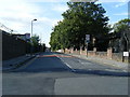
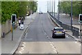
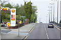

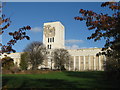
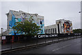
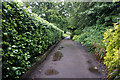
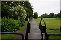
67 photos from this area
Area Information
Key information about the L7 0EF including its size, population, and administrative classification.
- Area Type
- Postcode
- Area Size
- 5689 m²
- Population
- 1784
- Population Density
- 9429 people/km²
House Prices in L7 0EF
30
Properties
£80,985
Average Sold Price
£18,000
Lowest Price
£215,000
Highest Price
Showing 30 properties
| Address | Type | Beds | Baths | Last Sale Price | Last Sale Date | |
|---|---|---|---|---|---|---|
| 71 Needham Road, Liverpool, L7 0EF | Terraced | 6 | 2 | £215,000 | Mar 2024 | |
| 113 Needham Road, Liverpool, L7 0EF | Terraced | 5 | 1 | £185,000 | Oct 2023 | |
| 69 Needham Road, Liverpool, L7 0EF | house | 3 | 1 | £125,000 | Oct 2022 | |
| 67 Needham Road, Liverpool, L7 0EF | Terraced | 2 | 1 | £103,000 | Aug 2021 | |
| 123 Needham Road, Liverpool, L7 0EF | Terraced | 4 | 2 | £100,000 | Aug 2018 | |
| 111 Needham Road, Liverpool, L7 0EF | Terraced | 3 | - | £80,000 | Jun 2016 | |
| 73 Needham Road, Liverpool, L7 0EF | Semi-detached | 6 | 3 | £98,000 | Nov 2015 | |
| 117 Needham Road, Liverpool, L7 0EF | Terraced | 4 | 1 | £67,000 | Sep 2015 | |
| 75 Needham Road, Liverpool, L7 0EF | house | - | - | £65,000 | Sep 2013 | |
| 109 Needham Road, Liverpool, L7 0EF | Terraced | 4 | 1 | £48,250 | May 2013 |
Page 1 of 3
Energy Efficiency in L7 0EF
Amenities
Schools
| Rank | School | Type | Entry gender | Ages |
|---|
Explore more schools in this area
Go to Schools tabDemographics
Household Size
Family (3-5 people)
most common
Accommodation Type
Houses
most common
Tenure
24
majority
Ethnic Group
White
most common
Religion
N/A
most common
Household Composition
N/A
most common
Age
22
median
Young Adults (15-29 years)
most common
Household Deprivation
N/A
with no deprivation
NS-SEC
10
in Lower managerial occupations
Explore more demographic insights in this area
Go to Demographics tabPlanning
Planning Constraints
- Flood RiskPremium
- Ramsar Wetland SitesPremium
- Area of Outstanding Natural BeautyPremium
- Protected Nature ReservePremium
- Protected WoodlandPremium