Area Overview for L69 7ZD
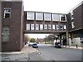
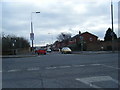
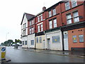
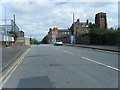
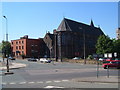
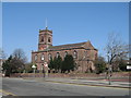
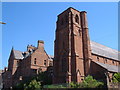
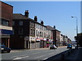
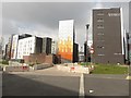
Photos of L69 7ZD


Area Information
Living in L69 7ZD means inhabiting a tightly packed residential cluster in England, where 2,403 people reside across just 1.6 hectares. The area’s compact size creates a dense, high-density environment of 150,723 people per square kilometre, a figure that underscores its intensity. This postcode is defined by its proximity to transport hubs, educational institutions, and retail centres, making it a practical choice for those prioritising connectivity. The presence of multiple railway stations, ferry terminals, and universities suggests a dynamic, commuter-friendly location. While the area lacks natural landscapes or protected sites, its strategic position near Liverpool’s core offers access to cultural and economic opportunities. Daily life here is shaped by a young demographic, with most residents aged 15–29, reflecting a student or early-career population. The mix of flats and rental properties indicates a transient community, though the area’s small footprint means its character is closely tied to its immediate surroundings. For buyers, L69 7ZD is a niche postcode where proximity to amenities outweighs space, appealing to those who prioritise convenience over expansive living.
- Area Type
- Postcode
- Area Size
- 1.6 hectares
- Population
- 2403
- Population Density
- 5816 people/km²
The property market in L69 7ZD is dominated by rental flats, with home ownership at just 12%. This suggests a market where private landlords or institutional providers hold the majority of properties, catering to students or transient workers. The prevalence of flats over detached or semi-detached homes reflects the area’s limited space and high density. For buyers, this small postcode offers few opportunities for owner-occupation, as the housing stock is primarily geared toward short-term tenancies. The immediate surroundings may hold more varied options, but within L69 7ZD itself, the focus is on rental availability rather than property investment. The compact size of the area means buyers must consider nearby zones for more traditional housing types. Those seeking to purchase here should expect a market where demand is driven by proximity to amenities rather than long-term residency.
House Prices in L69 7ZD
Showing 1 properties
| Address | Type | Beds | Baths | Last Sale Price | Last Sale Date | |
|---|---|---|---|---|---|---|
| Liverpool University Donnan And Robert Robinson Laboratories, Grove Street, City Centre, Liverpool, L69 7ZD | commercial | - | - | - | - |
Energy Efficiency in L69 7ZD
Residents of L69 7ZD benefit from a range of nearby amenities, including five retail outlets such as Co-op University of, Tesco Liverpool, and Tesco Myrtle. These shops provide essentials within walking distance, reducing the need for long journeys. The area’s proximity to multiple railway stations and ferry terminals ensures easy access to Liverpool’s urban centre and beyond, supporting both daily commutes and weekend travel. While parks or leisure facilities are not explicitly listed in the data, the density of retail and transport options suggests a focus on practicality over green spaces. The presence of universities and sixth-form colleges also adds a cultural vibrancy, with events or services catering to students and staff. Overall, the lifestyle here is convenience-driven, prioritising accessibility to work, education, and shopping over expansive recreational areas.
Amenities
Schools
Residents of L69 7ZD have access to a range of educational institutions, from primary schools to higher education. Nearby primary schools include Pleasant Street Primary School, rated ‘good’ by Ofsted, and St Nicholas’s Catholic Primary School, alongside St Nicholas RC Infant School. These options provide a mix of state and faith-based education for younger children. For secondary and further education, The City of Liverpool College offers sixth-form provision, while Liverpool John Moores University is within reach for higher education. This diversity of schools suggests a family-friendly environment where parents can choose between different educational philosophies. The presence of both primary and post-16 institutions ensures continuity in education, though the area’s small size means schools are closely clustered. For families, the proximity of multiple schools reduces commuting time, though the lack of specialist institutions like grammar schools may be a consideration.
| Rank | School | Type | Entry gender | Ages |
|---|
Explore more schools in this area
Go to Schools tabDemographics
L69 7ZD’s population is overwhelmingly young, with a median age of 22 and 15–29-year-olds forming the largest age group. This reflects a community dominated by students, recent graduates, or early-career professionals. Home ownership is minimal, with only 12% of residents owning their homes, indicating a rental-heavy market. The accommodation type is predominantly flats, a format that suits the area’s high density. The predominant ethnic group is White, though specific diversity statistics are not provided. The high population density—150,723 people per square kilometre—suggests a compact, possibly overcrowded living environment. This demographic profile implies a transient community, where short-term tenancies and student housing may dominate. For residents, the lack of homeownership and young age profile suggest a focus on temporary or flexible living arrangements. The area’s character is shaped by its youthful, possibly student-driven population, with limited long-term residential stability.
Household Size
Accommodation Type
Tenure
Ethnic Group
Religion
Household Composition
Age
Household Deprivation
NS-SEC
Explore more demographic insights in this area
Go to Demographics tabPlanning
Planning Constraints
- Flood RiskPremium
- Ramsar Wetland SitesPremium
- Area of Outstanding Natural BeautyPremium
- Protected Nature ReservePremium
- Protected WoodlandPremium